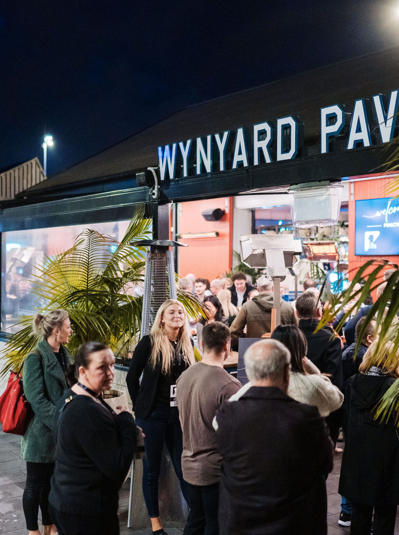
Discover New Zealand's Finest Venues
Featured venues
See all venues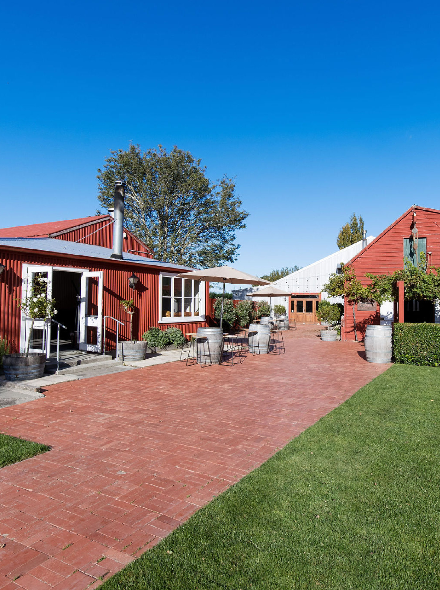
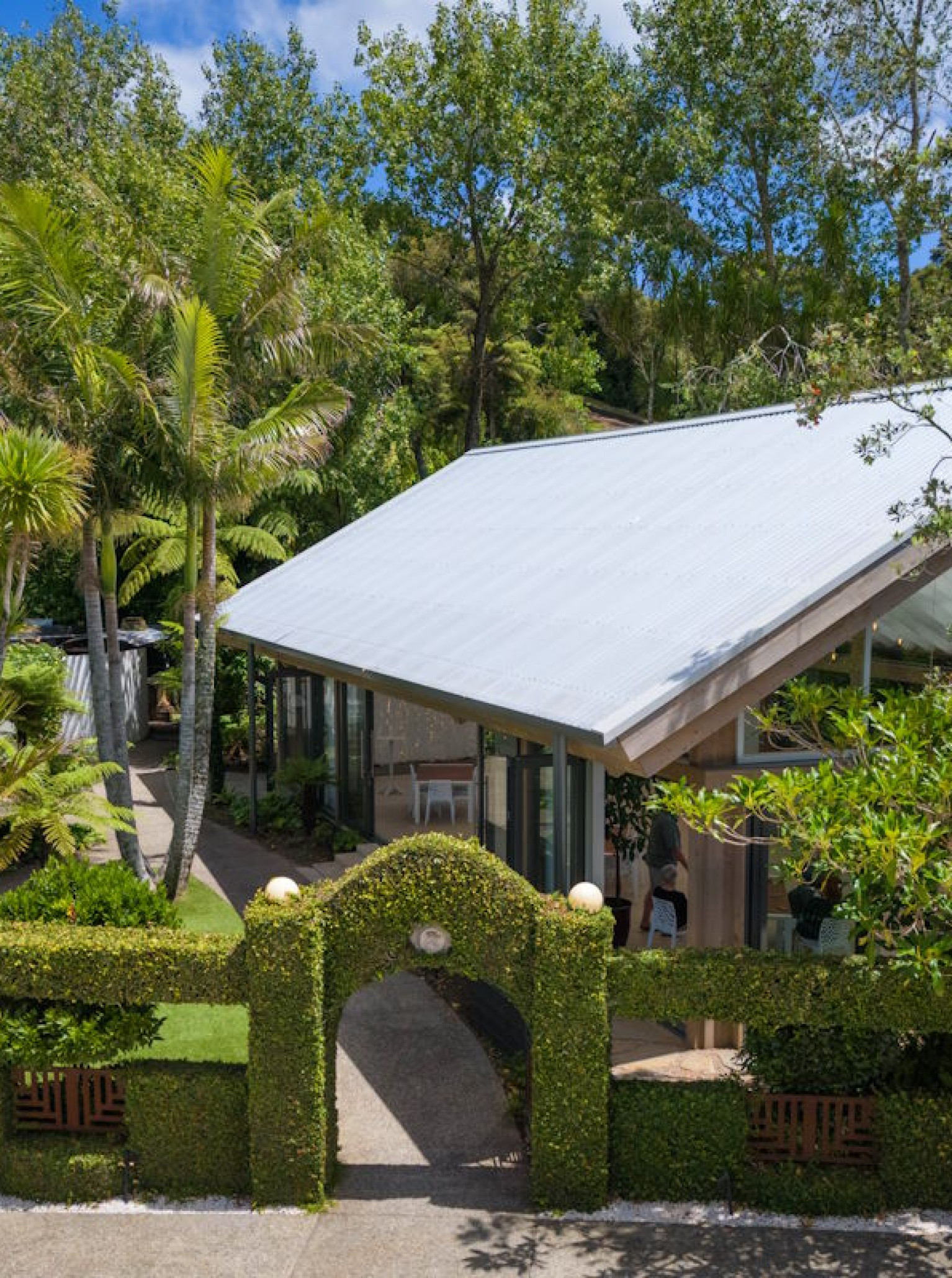
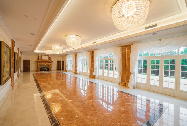
Larcomb Vineyard
For many years, Larcomb Vineyard has been involved in some of the most beautiful celebrations in the Canterbury region.

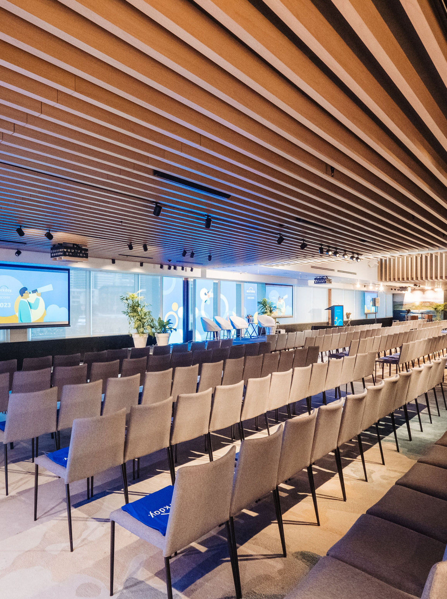
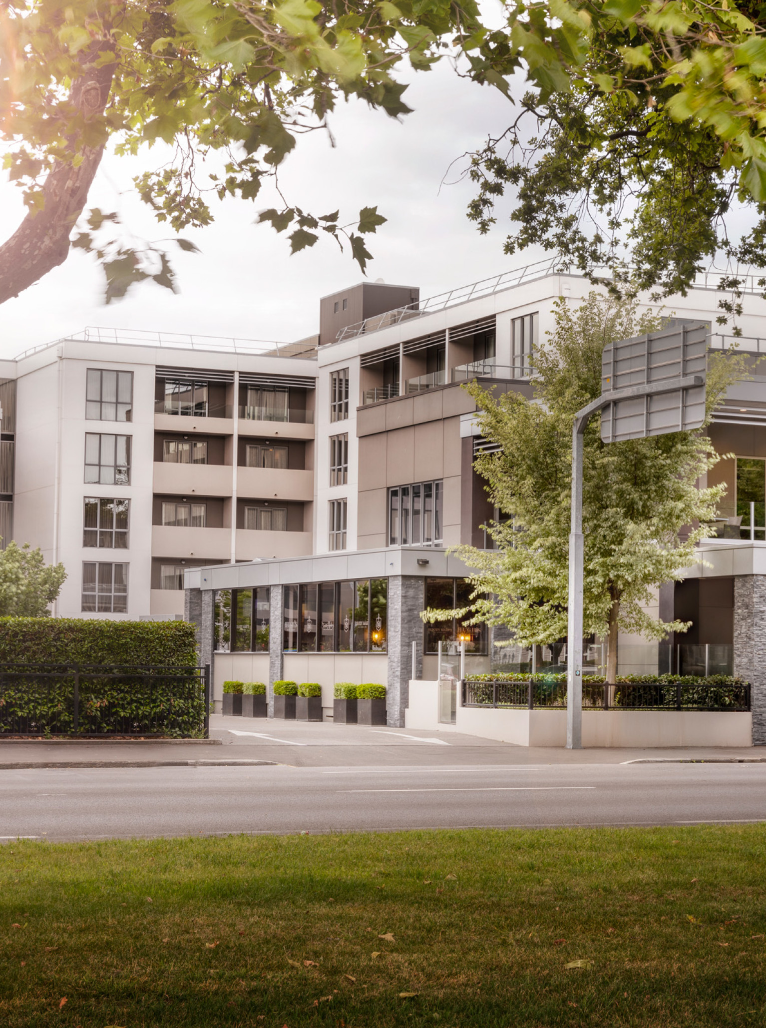
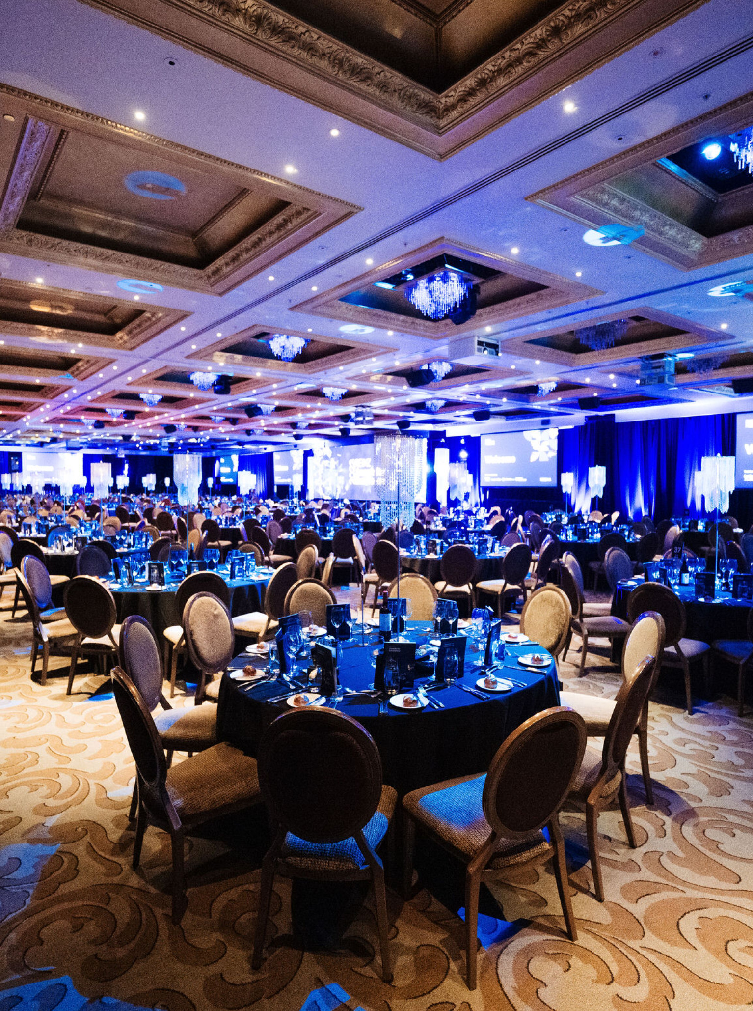
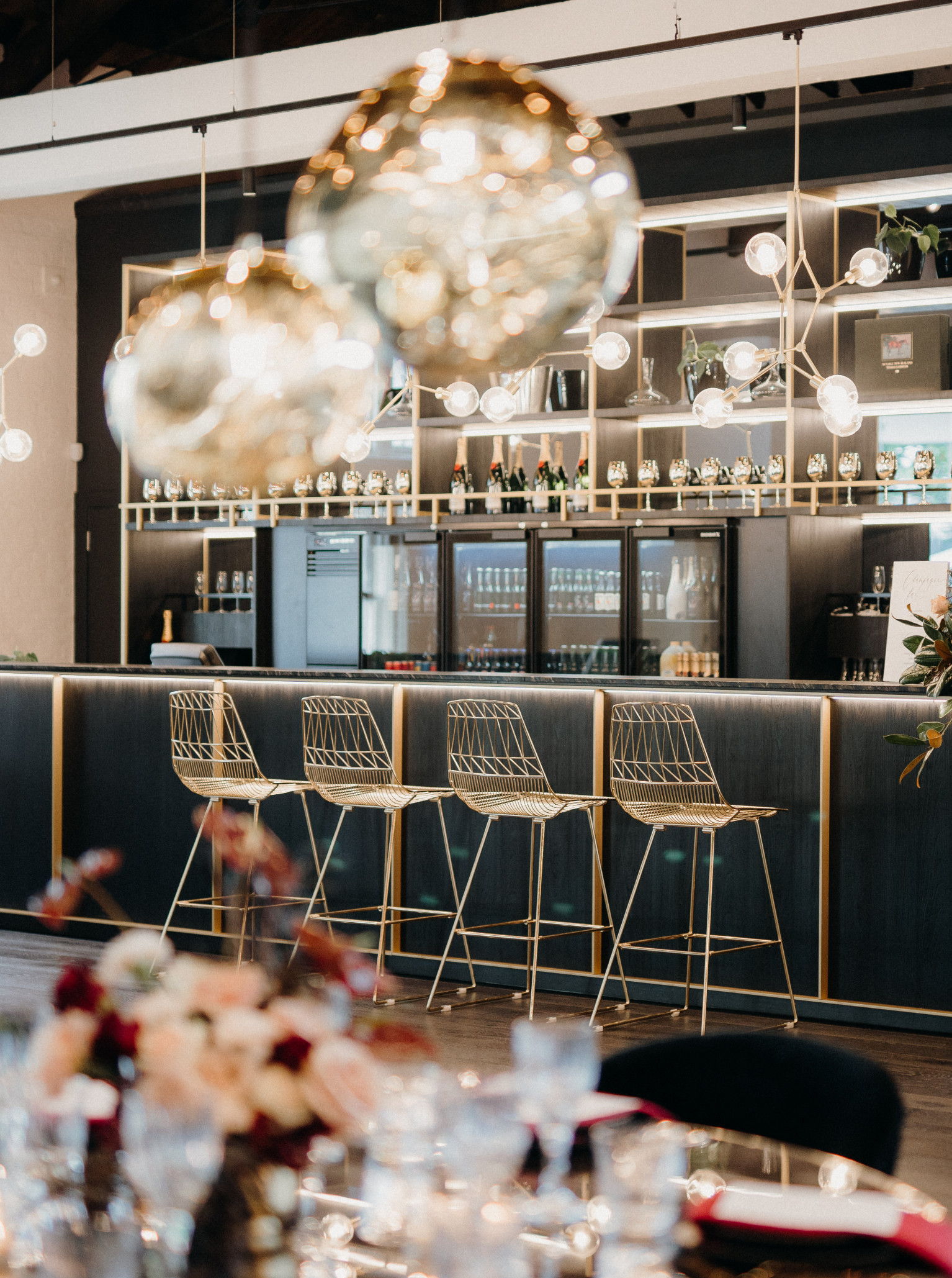
Pullman Auckland
OUR WORLD IS YOUR PLAYGROUND Standing tall as one of the largest conferencing hotels in the city, Pullman Auckland is an event planner’s paradise.
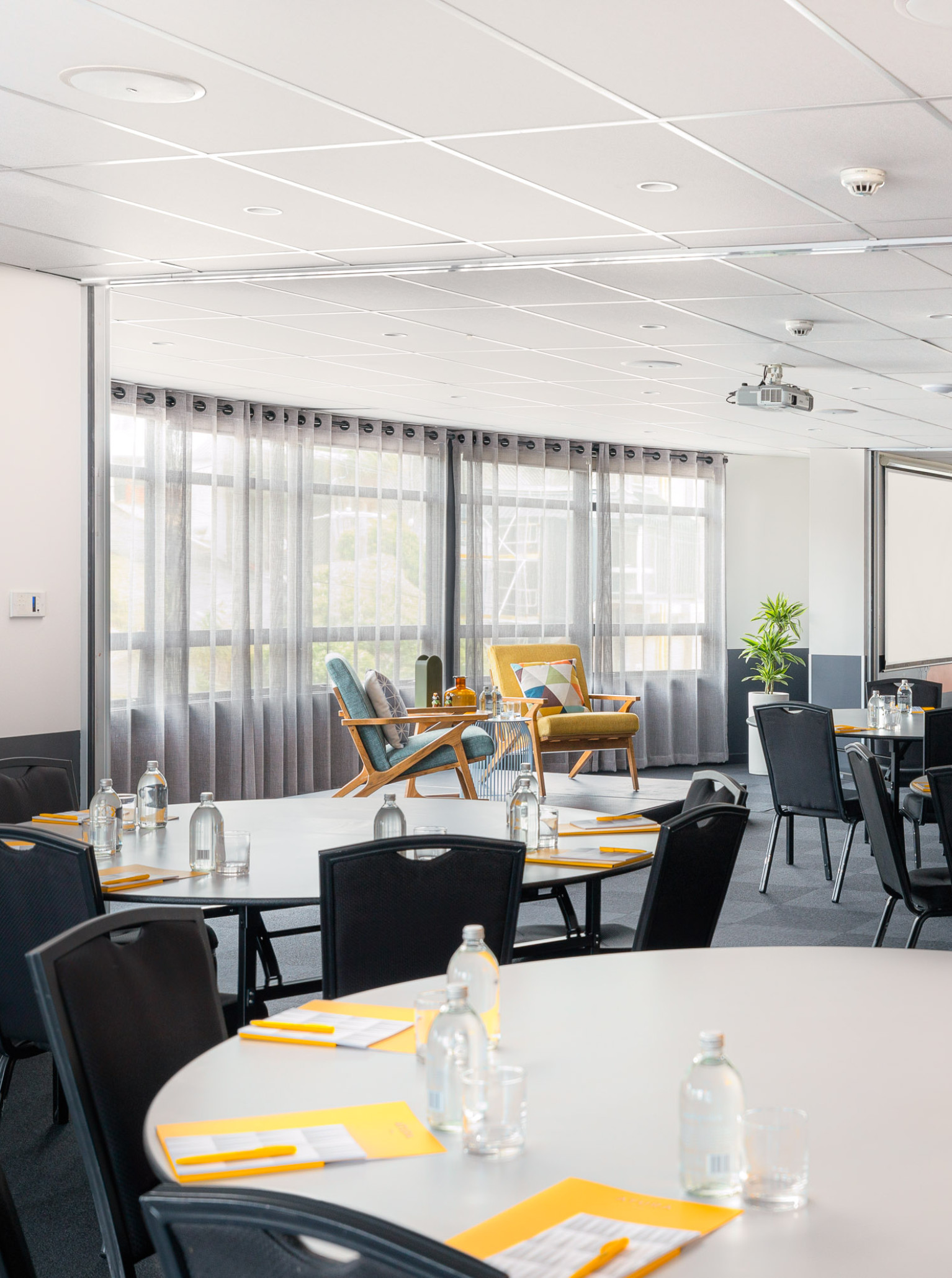
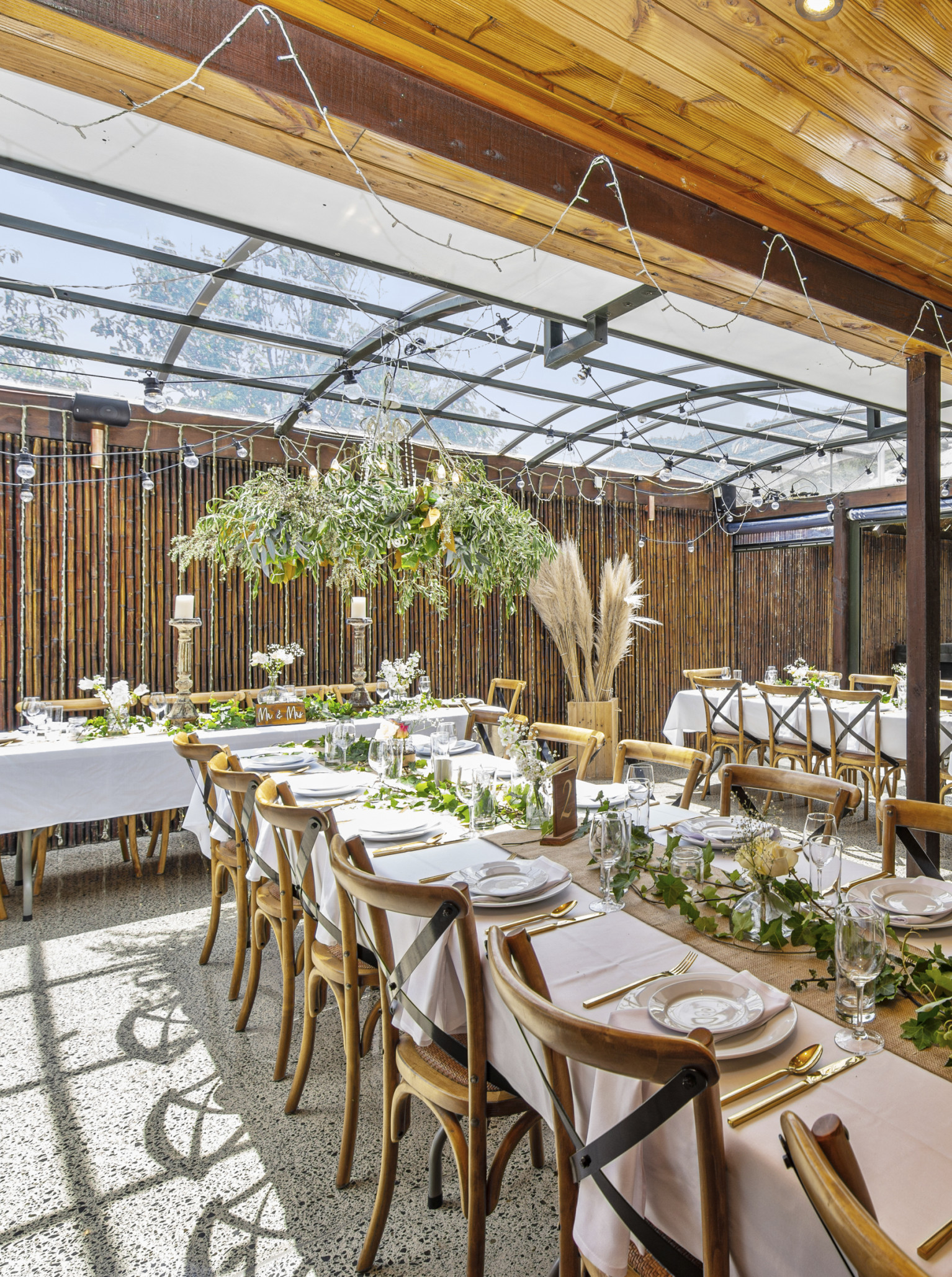
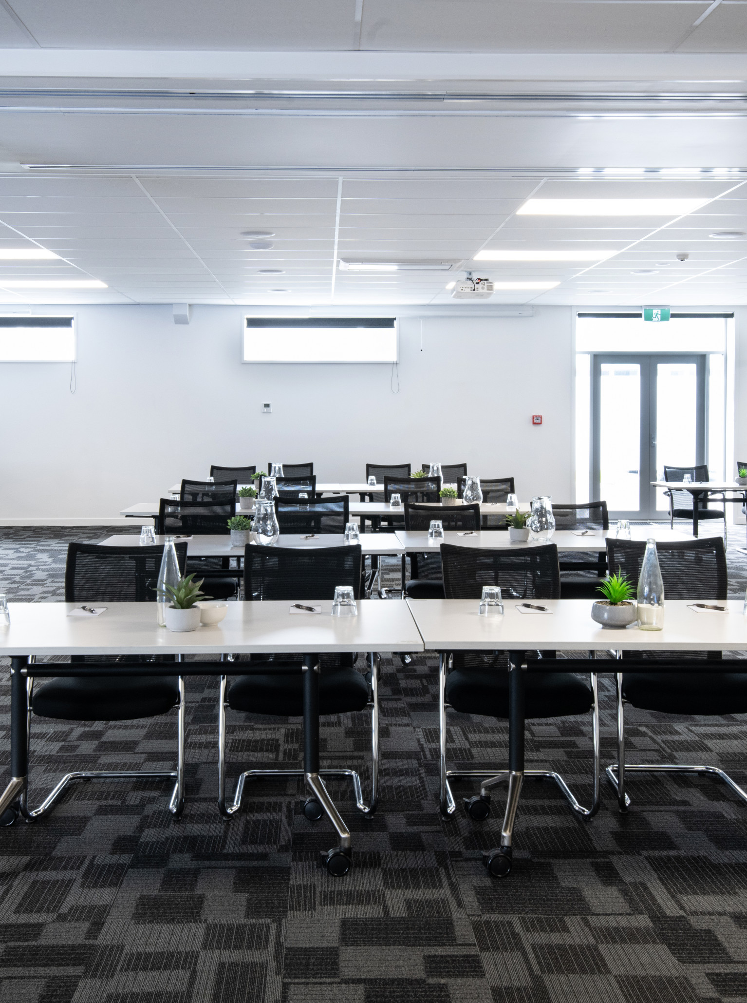
Atura Wellington
A streamlined experience awaits you at Atura Wellington. Set in the creative capital, this venue is conveniently within walking distance of the business and government precinct, the waterfront and all the must-see locations.
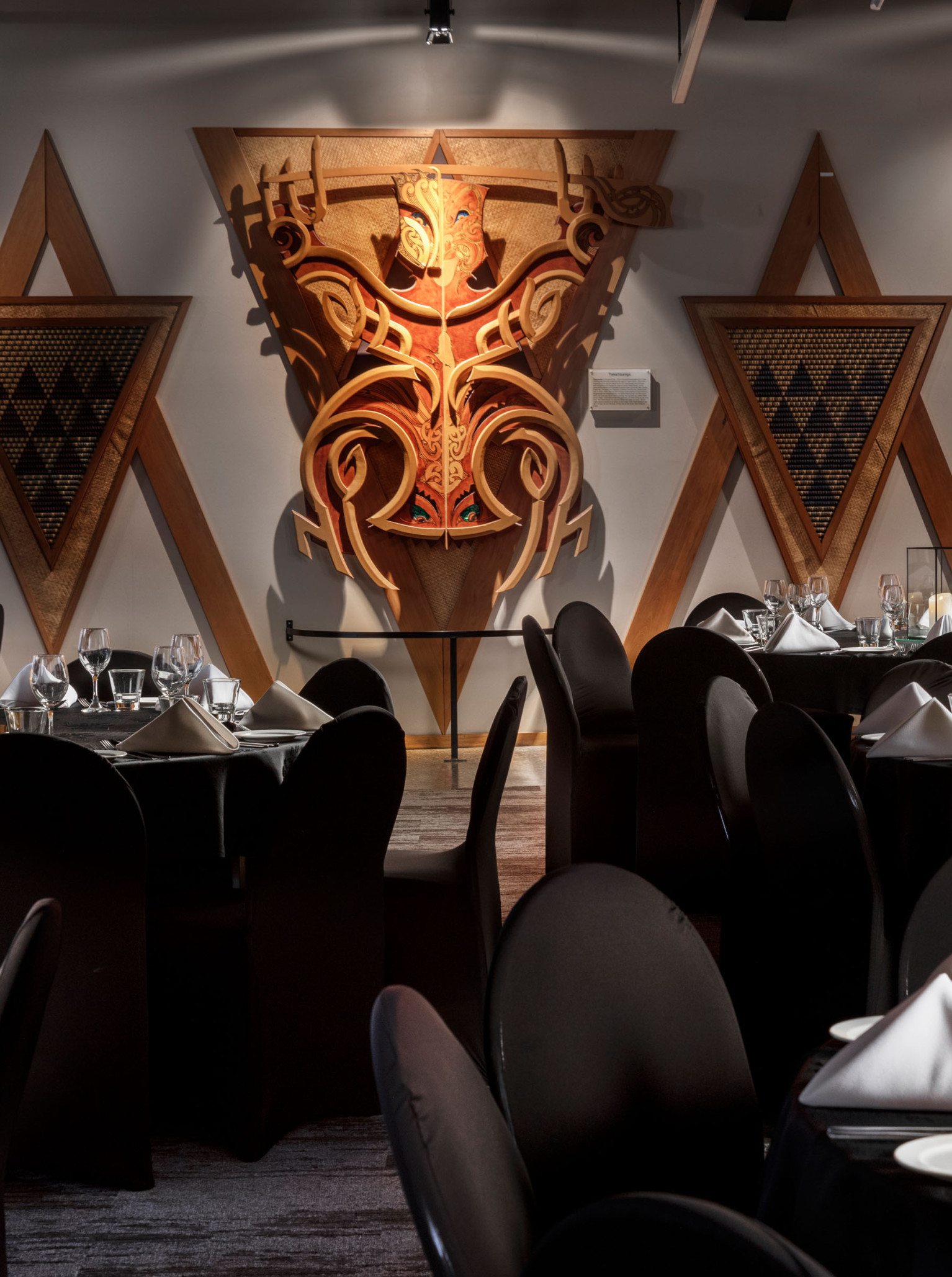
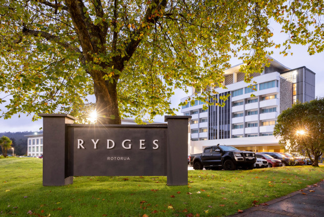
Rydges Rotorua
Located on the edge of the famous Redwood forest and overlooking Whakarewarewa Geothermal Reserve and Historic Village, you'll find Rydges.
Palmy Conference Centre
Palmy Conference + Function Centre is a sophisticated and innovative venue that will set you up for success.
QT Auckland
QT Auckland is an eclectic, harbourside hotel venue with a glint in the eye, serving shoreline shimmer. Whether hosting a vibrant birthday gathering or a more exclusive affair, they'll dress all types of events in a warm QT glow and guarantee a touch of Auckland city wonder.
Man O' War
Spanning an impressive 4,500 acres, Man O' War Vineyards is a renowned winery and venue on the Eastern end of Waiheke Island. Of the 100 vineyards on the Island, you'll find 75 of them on Man O' War land.
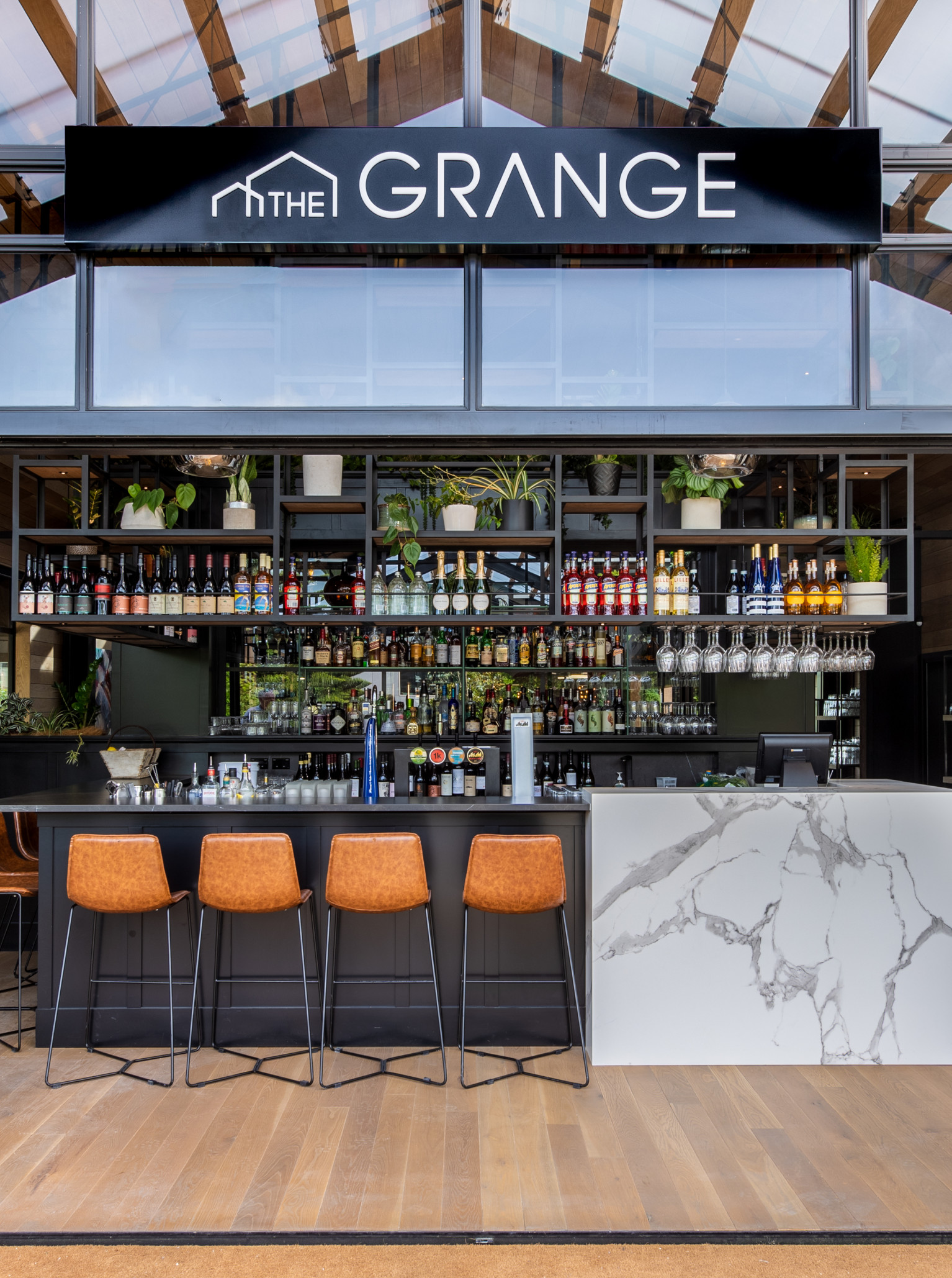
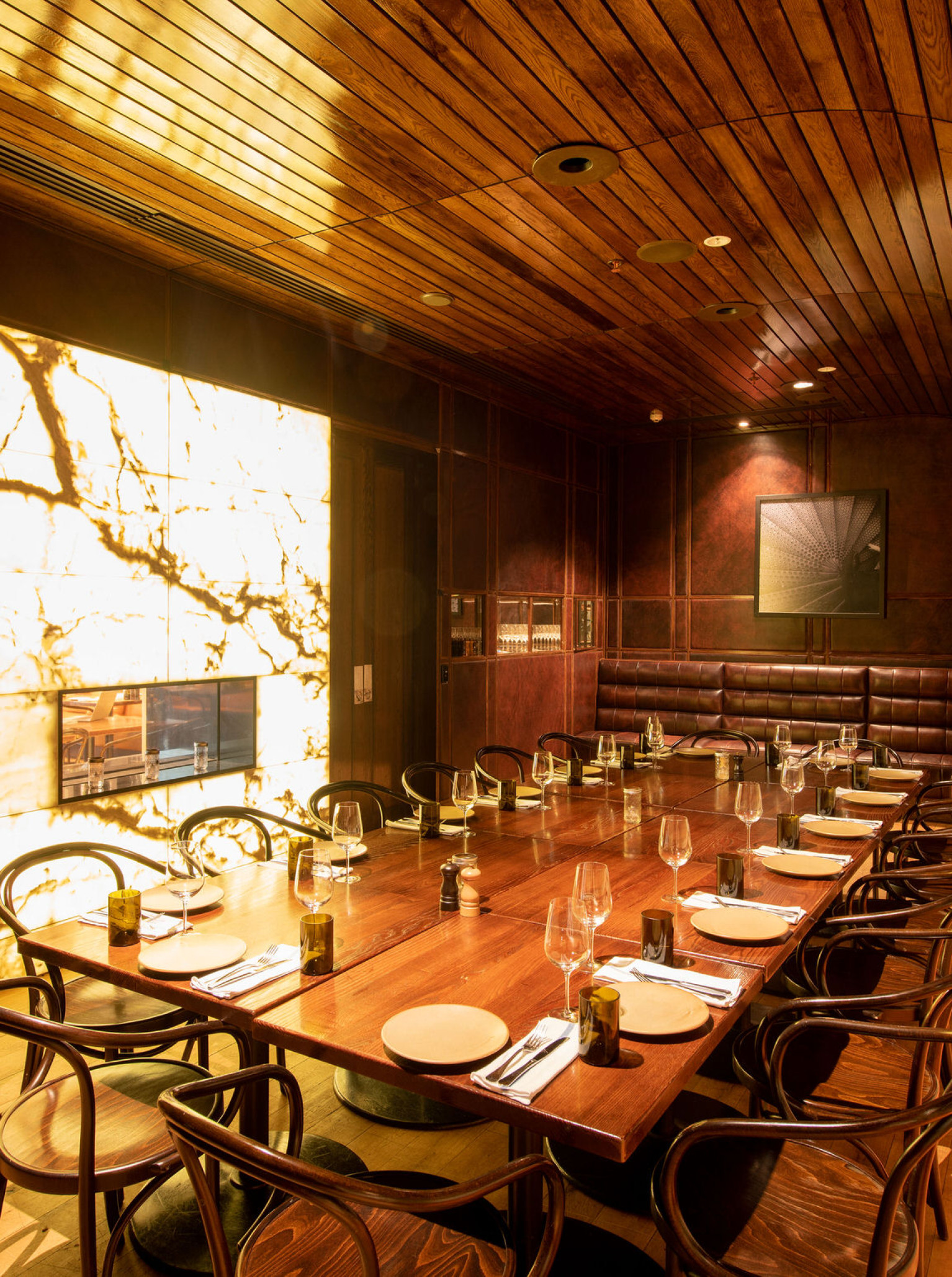
The Grange
Nestled in the warmth of Takapuna, The Grange is a snappy bistro with a European edge, certain to lend your event unparalleled style.
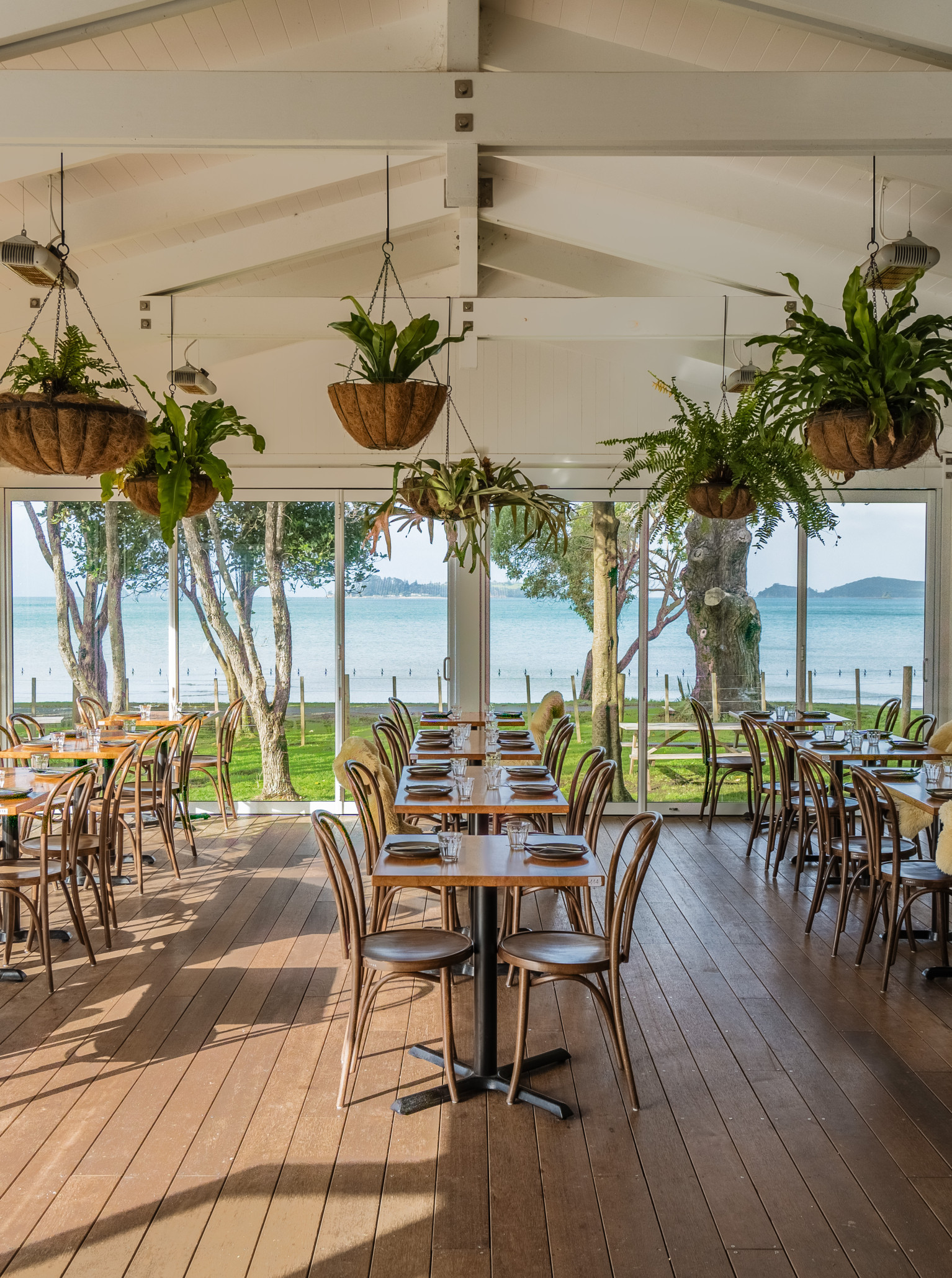
Okahu
Sitting on the cusp of Okahu Bay, this venue boasts an unmatched view of the ocean extending directly below it. Sparkling waters spread for miles, offering clear views of Rangitoto and the harbour by day, and a dazzling cityscape by night.

Kauri Bay Boomrock
Kauri Bay Boomrock is not simply a place to visit, but a place to experience. Located on 500 acres of Clevedon countryside, this venue sets the scene for an exceptional event.
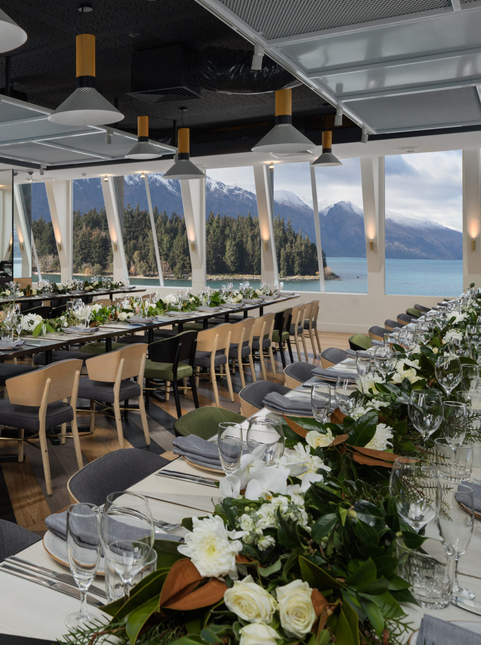
QT Queenstown
QT Queenstown is a bedtime story that turned out to be true. An impeccably styled lakeside heaven with a little added quirk, the award winning hotel venue surrounds you with Wakatipu’s visual magic. Renowned for hosting distinguished events, QT Queenstown presents world-class spaces, facilities, catering and accommodation, at QT Queenstown you’ll be dreaming big.
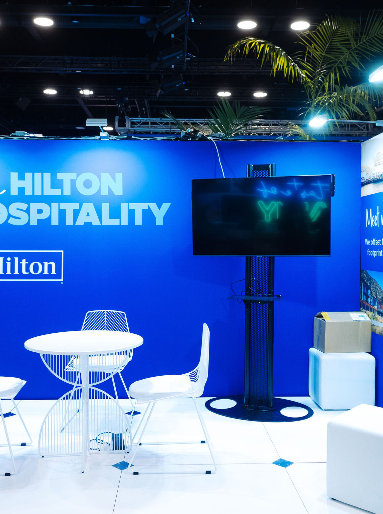
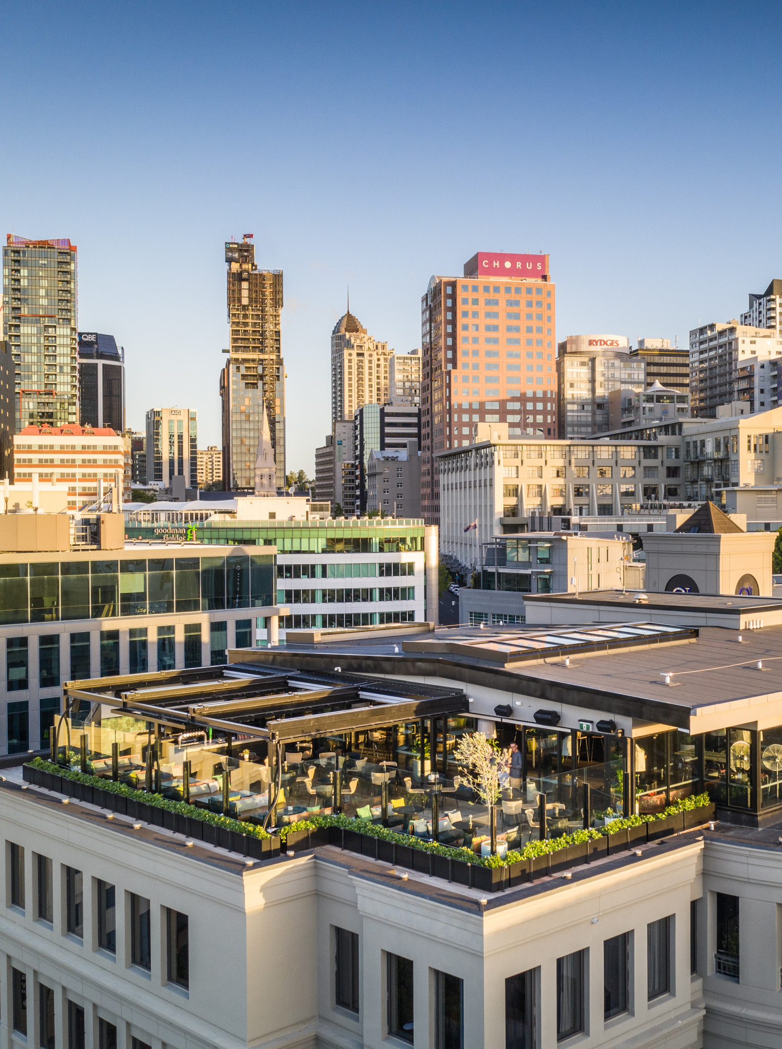
Hilton Auckland
Hilton Auckland is one of the most iconic buildings on the city’s skyline, carrying the name of one of the most iconic hotel brands in history.
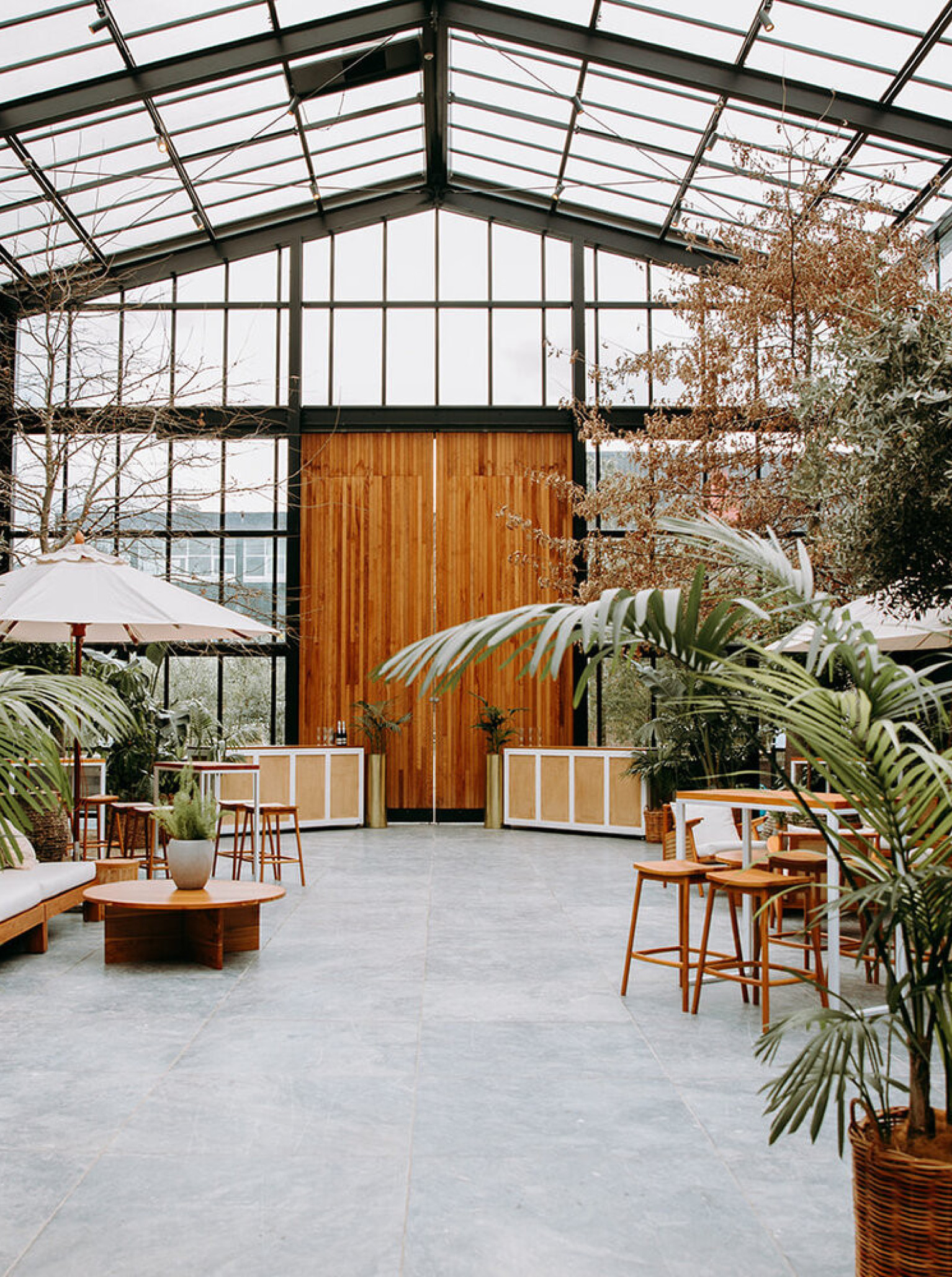
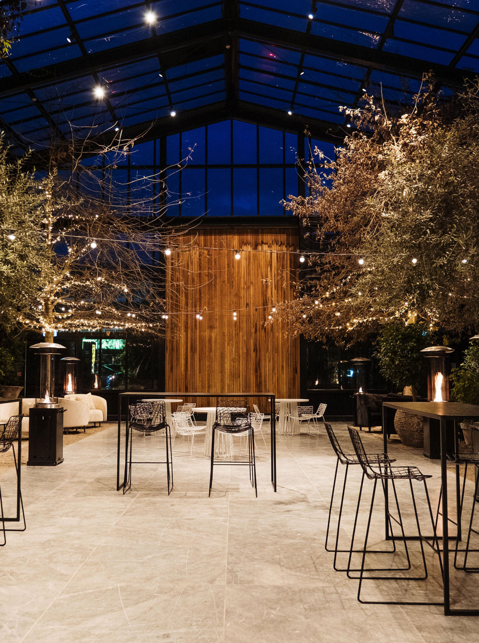
Glasshouse
An urban oasis in the heart of Auckland city, Glasshouse in Morningside offers a calm and serene space, hidden from the hustle and bustle of the city.
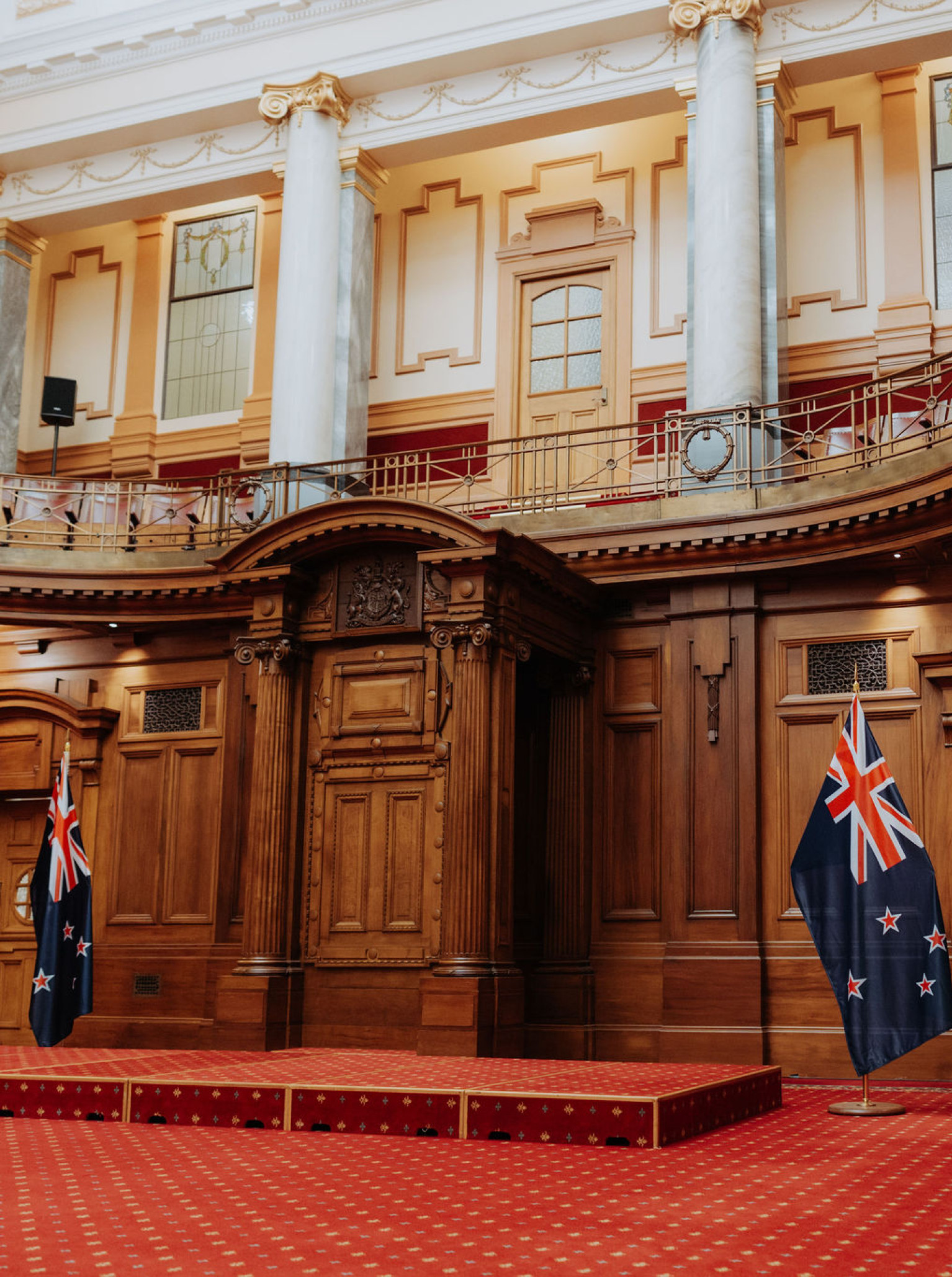
Parliament Buildings
For an event with unparalleled prestige, choose the heart of New Zealand's democracy - The Parliament Buildings in Wellington.
Aston Norwood
Aston Norwood, a beautiful venue situated at the foot of the Remutaka Hill in Wellington Region.
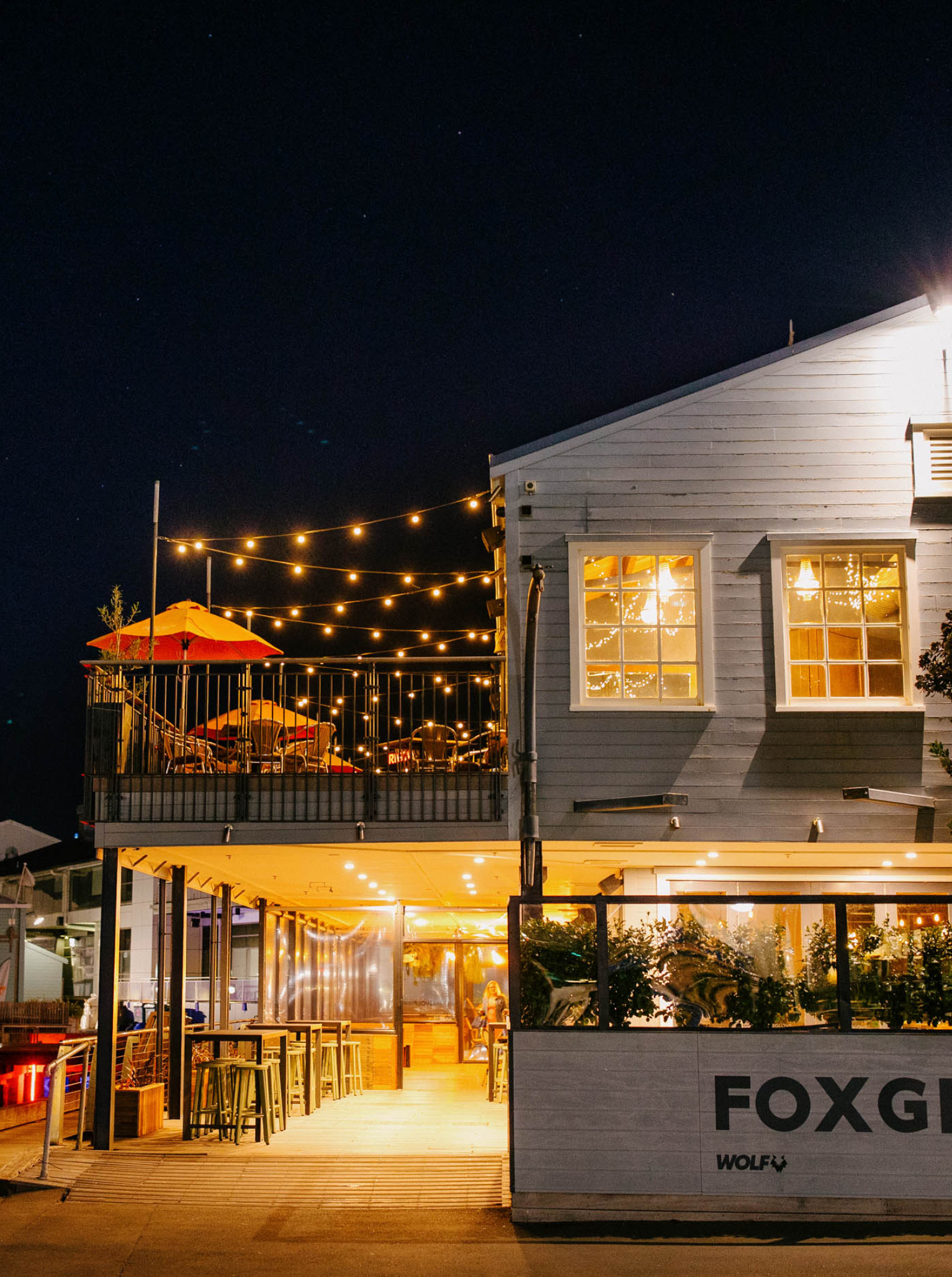
Foxglove Bar
Located in a beautiful heritage building on Queens Wharf, Foxglove Bar & Kitchen is a Wellington venue with three event spaces.
Flaxmere House
Tranquillity meets productivity at Flaxmere House, the ultimate conference venue. Set on a 10-acre lifestyle block by Bethells Beach, Flaxmere House is a boutique space with accommodation for up to 20 guests.
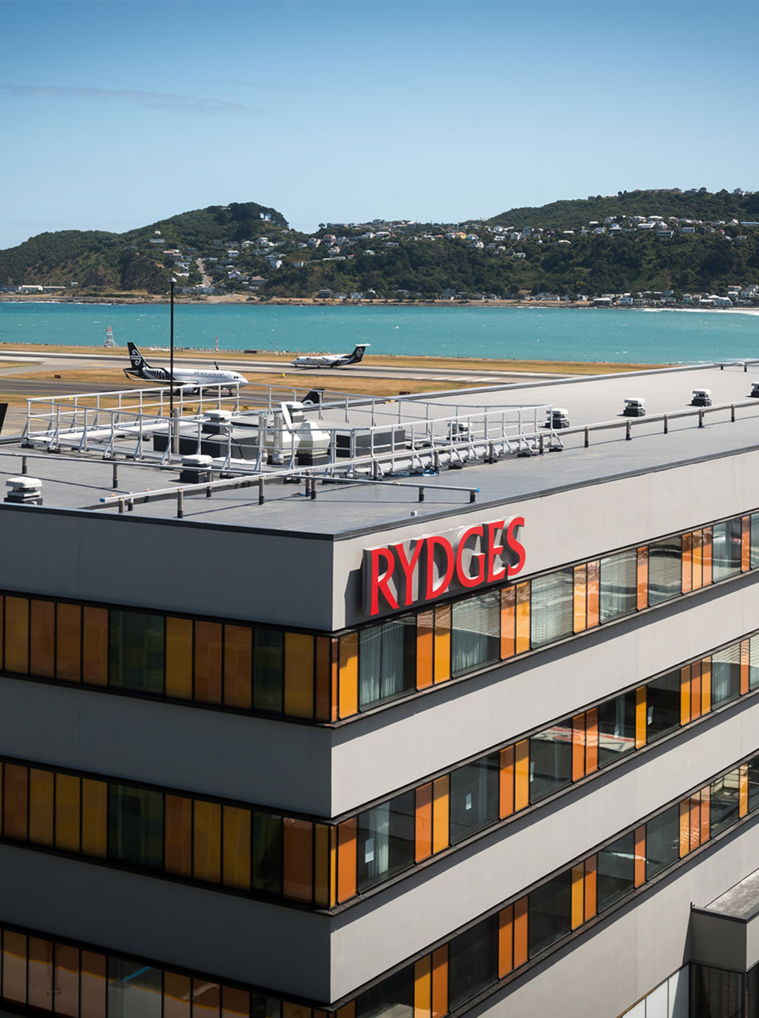
Rydges Wellington Airport
Save time and skip to the good part at Rydges Wellington Airport. Situated at the Wellington Airport terminal, Rydges is the most accessible and comprehensive conference venue for guests flying in from out of town.
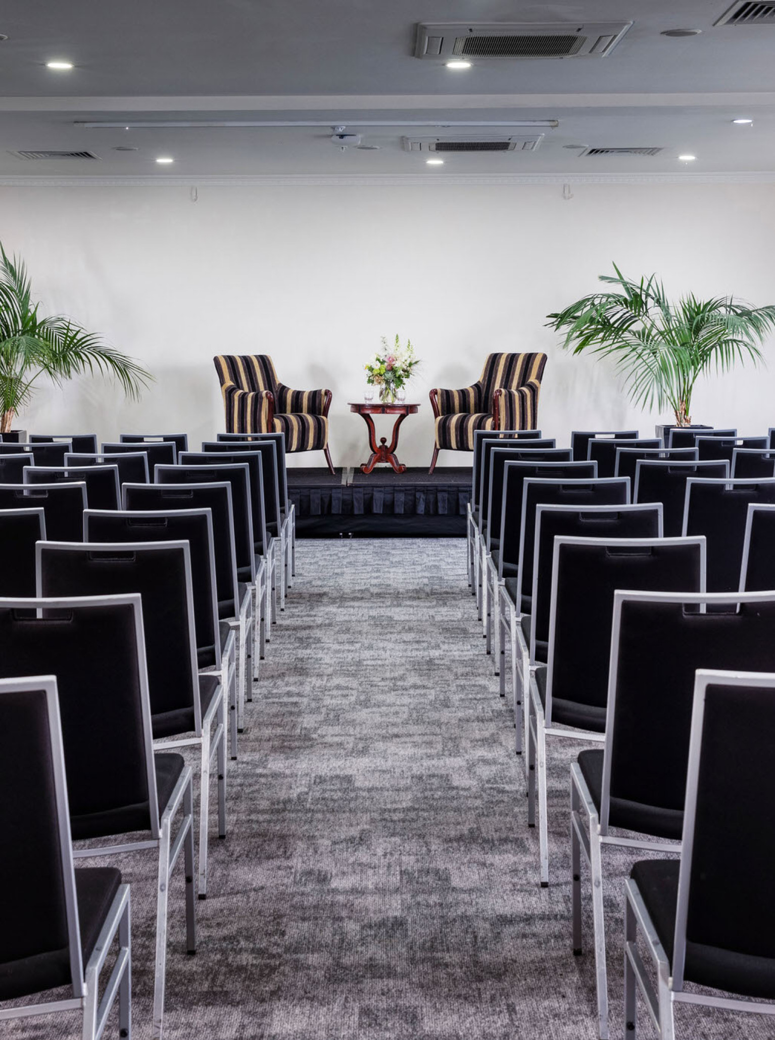
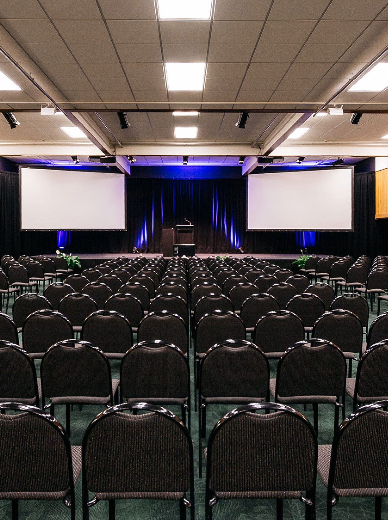
Arawa Park Hotel
Arawa Park Hotel Rotorua is a comprehensive conference and wedding venue overlooking the city of Rotorua. Arawa Park Hotel Rotorua boasts over 560 square metres of conference and function space, utilising 6 separate rooms with free Wi-Fi.
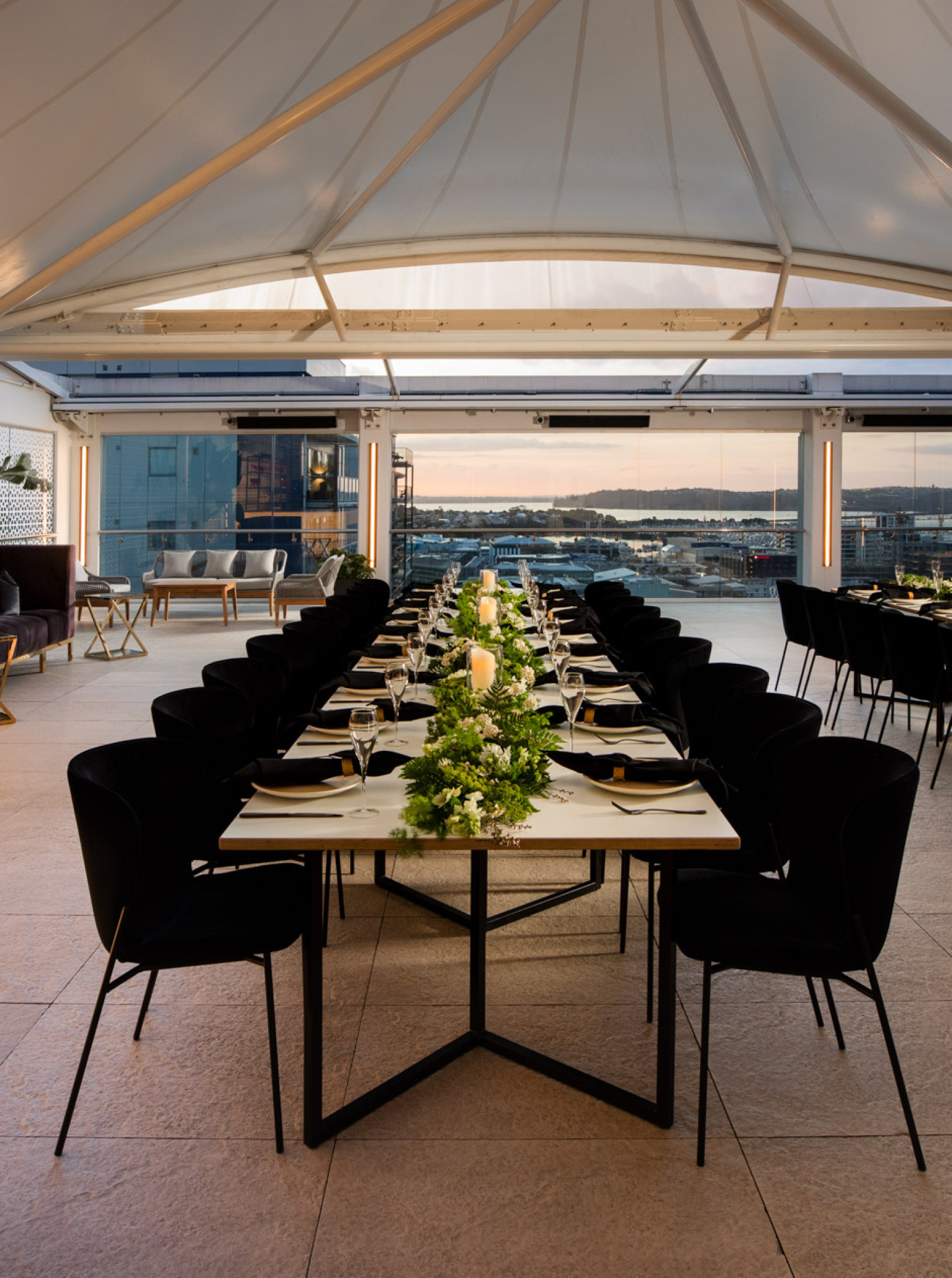
Rydges Auckland
Rydges is one of the most breathtaking venues in the City - presenting uncompromised harbour views from the Rooftop.
Tui Hills
A uniquely NZ venue nestled in the native bush of the Waitakere Ranges. Host a party, presentation, wedding or meeting - just 30 mins from the CBD.
Rydges Latimer
Situated in the heart of the garden city, Rydges Latimer Christchurch boasts spacious in-hotel conference facilities and a refined setting for functions and celebratory events.
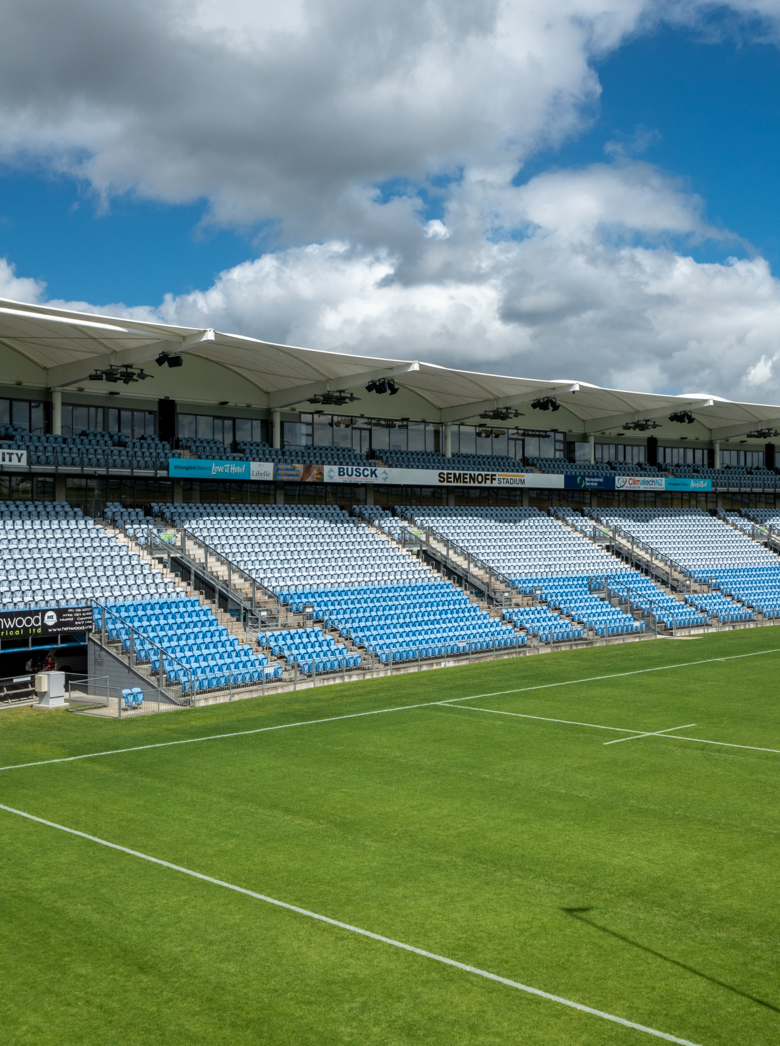
Semenoff Stadium
A multipurpose facility that brings a larger-than-life feel to every event, Semenoff Stadium is Northland's busiest venue.
Abel Estate
Unforgettable occasions in the heart of Kumeu wine country. Get away from the hustle and bustle of the city for an event to remember, whether that's team building, a business meeting, birthday, wedding, or one of our legendary Christmas parties.
NZCIS
Situated in Trentham, Upper Hutt, NZCIS offers an impressive range of conference solutions to meet your needs. With versatile spaces, comfortable accommodations, exquisite catering services, and a stunning location, NZCIS is your all-inclusive venue for a successful event.
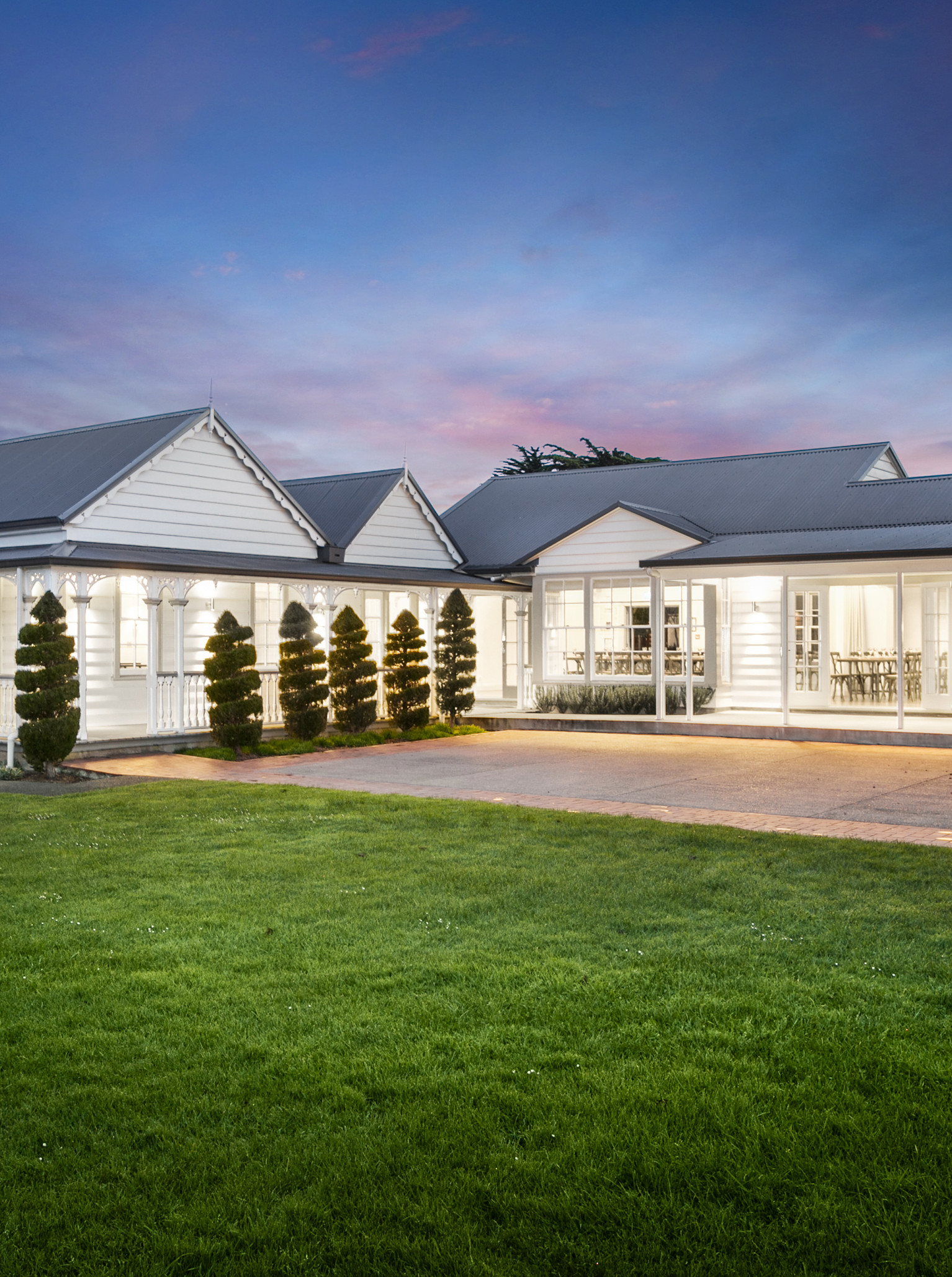
Abbeville Estate
The heritage-listed buildings and landscaped grounds that make up Abbeville Estate are over 150 years old and have been meticulously restored and contemporized for the needs of today.
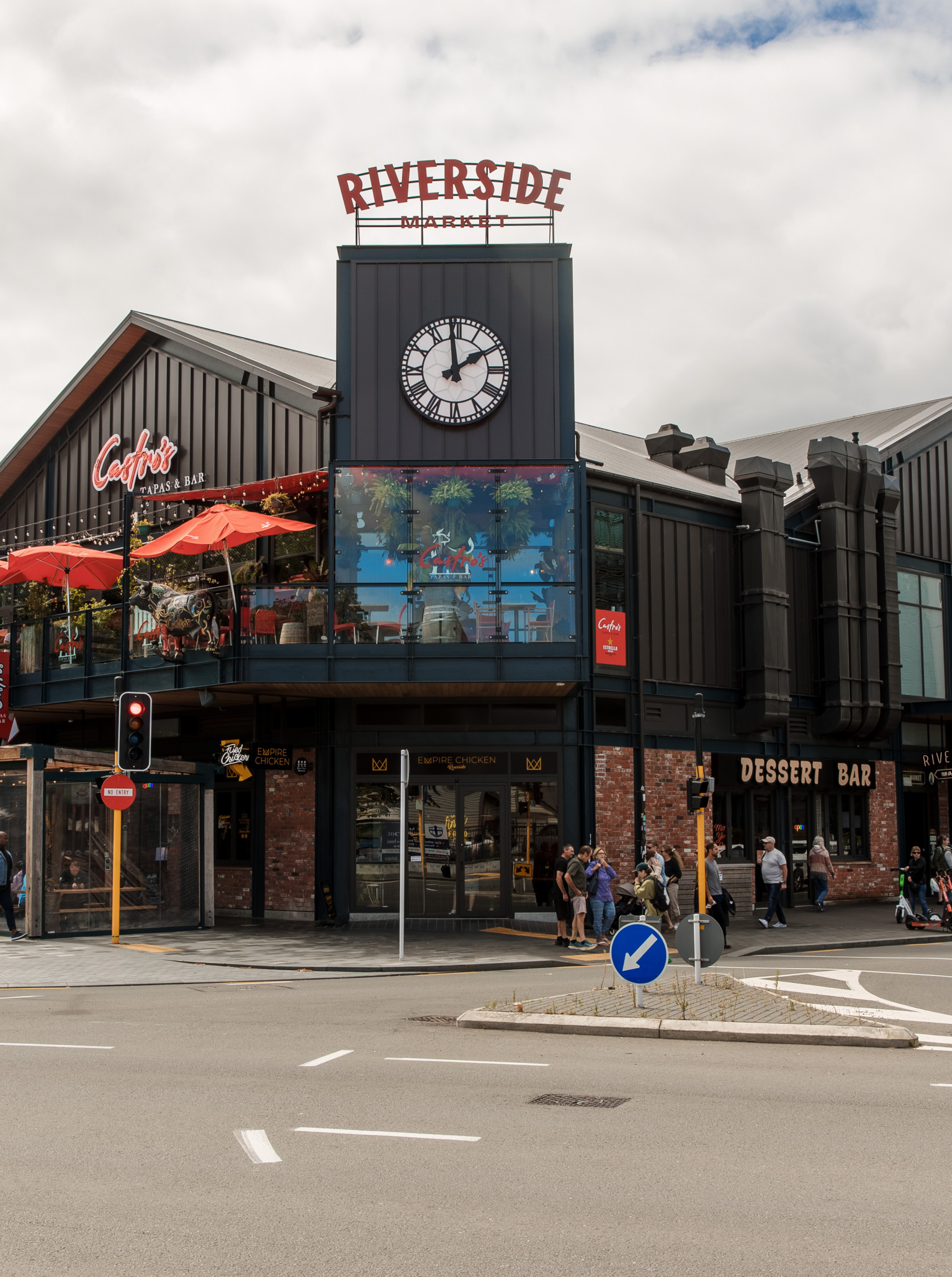
Riverside Market
Riverside Market is an award-winning 7-day destination indoor trading market, in the heart of the city, offering a unique after-hours event experience.
Vanderosa Farms
Vanderosa Farms is a breathtaking venue set on a ridgeline 300m above sea level. Minutes from Leigh, Vanderosa Farms overlooks Pakiri Beach and surrounding farmland.
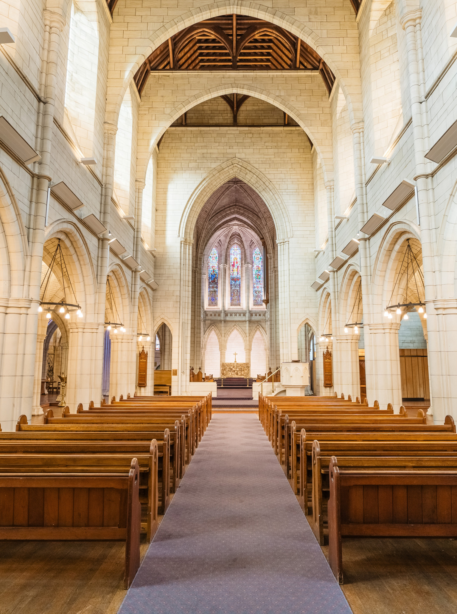
St Matthew-in-the-City
Sitting proudly in the heart of Auckland, St Matthew's is a majestic neo-Gothic piece of history, serving as a unique venue in the city.
QT Wellington
QT Wellington is an eccentric hotel venue in the heart of our capital city. Surrounded by a blend of urban and harbour views, QT Wellington offers colourful spaces, state-of-the-art facilities and decadent dining.
Fantail & Turtle
A welcoming bar, eatery & micro brewery with two bars, open plan spaces, and a huge all-weather landscaped outdoor bar & dining area. Just 10 mins from the CBD in the heart of Takapuna.
Lone Pine Estate
A venue with everlasting opulence, Lone Pine Estate is the culmination of Renaissance architecture, gardens and luxury.
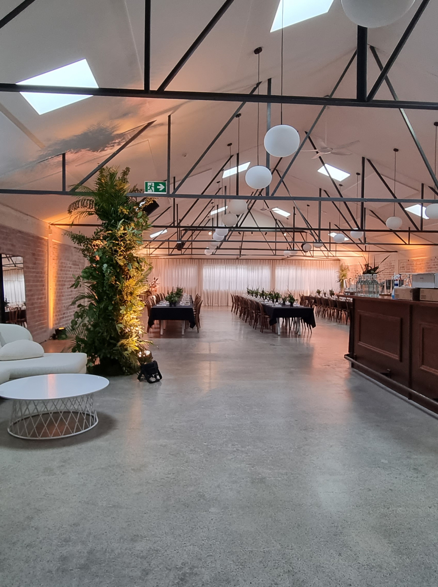
Whisky & Wood
A blank space venue with a character of its own. Featuring washed-brick walls, soaring high ceilings, skylights and a wooden bar area, Whisky & Wood exudes industrial elegance.
Get inspired by our blogs
See all blogsHawke's Bay Venues for Hire - The Complete Guide
Set on the East Coast of the North Island, Hawke's Bay is known as the Art Deco capital of New Zealand. Following a devastating earthquake in the 1930s, the city was rebuilt in this classic style and to this day, the streets exude vibrance and 1920s glamour. If there's one other niche for which Hawke's Bay is known, it's the wine. Boasting a plethora of award-winning wineries - Hawke's Bay produces some of the country's finest drops. Many of these wineries are beautiful venues for weddings, private functions and corporate affairs.
30 Stunning Auckland Venues for Product Launches
Launching a new business or product is a milestone well worth celebrating! When selecting a venue for the official event, you want a space that compliments the occasion and directs the focus to your product. Whether you seek a malleable, blank-space venue that you can deck to the nines with your branding - or somewhere with a distinct character that requires little decoration, Auckland serves. Put your best foot forward with our hand-picked list of venues perfect for product launches.
Wanaka Venues for Hire - The Complete Guide
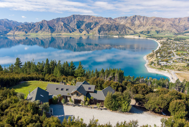
For those who love an alpine landscape but wish to escape the bustle of Queenstown, venture an hour further, and you'll find the breathtaking lakeside township of Wānaka. With glassy waters and snowcapped mountains for as far as the eye can see, the Wānaka region is as pretty as a postcard. As the gateway to the Southern Alps, Wānaka has many beautiful venues, from luxury lodges to heritage hotels, lakeside restaurants, and high country stations. Whether in town for work or play, you couldn't pick a more beautiful region to host your event. If you're looking for our guide to Queenstown venues, you can find it here.
Wellington Wedding Car Hire
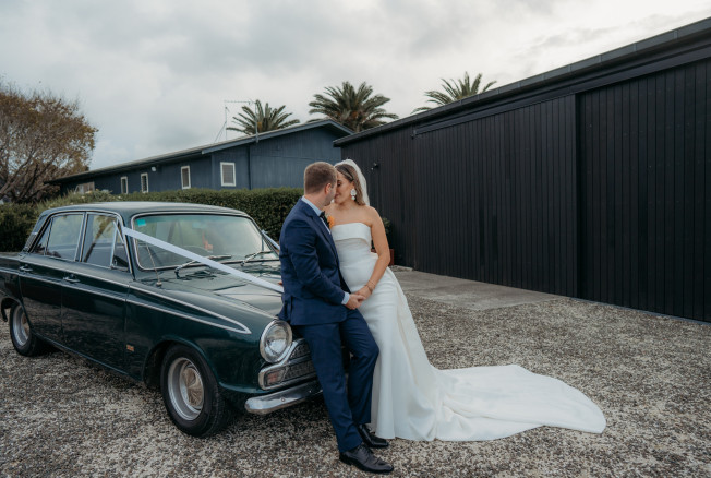
Welcome to the world of luxury wedding cars. Hiring a luxury car to transport you to and from your wedding festivities is a great option for those seeking to add a level of prestige to their wedding day. Whether you're after something classic, sporty or even a limousine - travelling in style is sure to make an impression. Not to mention, the vehicle will also serve as an epic prop for your wedding photos. Make an entrance for the ages with one of these Wellington-based luxury car hire companies.
Wellington Wedding Marquees for Hire
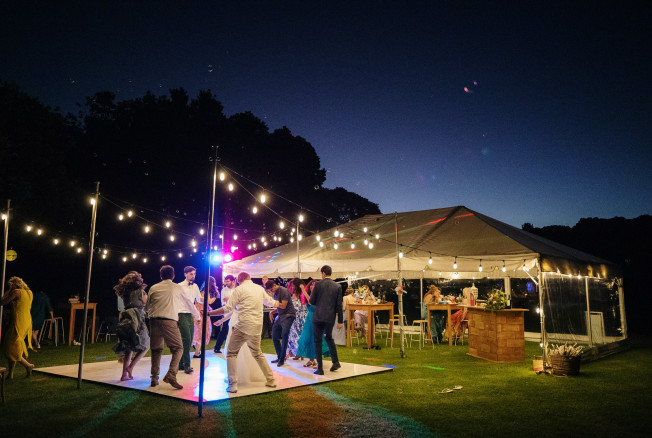
In need of a marquee? We've got you covered. Aside from being a functional shelter, a marquee is also a canvas from which to create the most magical wedding reception. Whether you choose a stretch tent, teepee or clear marquee - adorn it with festoons and fairy lights and watch your wedding night come to life. In this section, discover the best marquee hire companies servicing the Wellington Region.
The Best Wedding Planners and Stylists in Wellington
Let's talk wedding planning. It can appear to be an overwhelming task, but with the right resources and support, it can also be incredibly fun! After all, it's the day that many dream of coming around. Whether you need a little help or a lot, you've come to the right place. We've collected a list of wedding wizards specialising in consultation, planning, creating, on-the-day coordination, and everything in between. These experts are here to lighten your load and make your day the best it can be. Without further ado, here are our favourite wedding planners and stylists in Wellington.
Wellington Wedding Hair and Makeup
You're in the thick of wedding planning. Hopefully, you've ticked off the big ticket items, such as your wedding venue and photographer. Now, it's time for the fun part - hair and makeup! A beautiful wedding look will set you up for success. Not only on your big day but also in your wedding photos, which will live on forever. Achieving a look that is totally you calls for an expert artist who understands your complexion, facial structure, and desired look. An experienced makeup artist will also know how to create a long-lasting look that still looks fantastic after the tears, laughter, and sweat that your wedding day will undoubtedly bring. With that in mind, we've called upon Wellington's top hair and makeup artists. These beauty experts will ensure a beautiful & long-lasting bridal look for your big day.
Wellington Wedding Photographers
As we've touched on in our Wellington wedding vendors blog, photography is undoubtedly one of the best investments you can make for your wedding day. It's a once-in-a-lifetime kind of occasion and worth capturing well. Thankfully, Wellington is inundated with incredible photographers. Though this is great news, it can make the selection process difficult. With so many options, how do you narrow them down and find the photographer for you? There are several factors to consider - style, personality and budget.
Wellington Wedding Vendors
You've booked your dream Wellington wedding venue, and the scene is set. Next up, you need a great team of vendors to bring your day to life. From award-winning photographers to passionate wedding planners and thoughtful makeup artists to luxury car chauffeurs - you'll find incredible wedding vendors in every corner of this beautiful region. Browse our curated list of Wellington wedding vendors, and let the planning begin!
Christchurch Venues for Hire - The Complete Guide
Something old meets something new in Christchurch, the garden city of New Zealand. The city has undergone major restorations in the last decade, and as a result, the region's event scene is livelier than ever. Famous for its beautiful gardens, English architecture and vibrant arts community - Ōtautahi is a beloved place amongst locals and travellers alike. Moreover, this southern city has an abundance of venues rich in character and design flair. Discover our favourite venues in Christchurch, from heritage buildings to high-tech facilities, luxury hotels, and out-of-town vineyards. Without further ado, let's dive into it! Here's our complete guide to Christchurch venues.
Bay of Plenty Venues for Hire - The Complete Guide
Extending from the Coromandel Peninsula in the west to Cape Runaway in the east, the Bay of Plenty region is best known for its picturesque coastline and marine life. Aptly named, the region is plentiful when it comes to venues for hire. We've compiled a list of the region's finest - from luxurious hotels to down-to-earth community spaces. For our guide to Bay of Plenty wedding venues, click here.
Auckland Venues for Hire - The Complete Guide
The City of Sails, Auckland, is a hotspot for all manner of events: cocktail parties, gala dinners, conferences, seminars, meetings and so much more. No matter how big or small, Auckland has unique venues to cater to your event, be it with a contemporary or traditional with a twist. With the famed Sky Tower at its centre offering serene views of the Viaduct Harbour, as well as Auckland Domain, the city’s oldest park, there is a wealth of spaces in Auckland to choose from when considering a venue for your next Auckland event. We have a list of the best venues for hire in Auckland, from the cosy and conventional to the modern and dynamic.
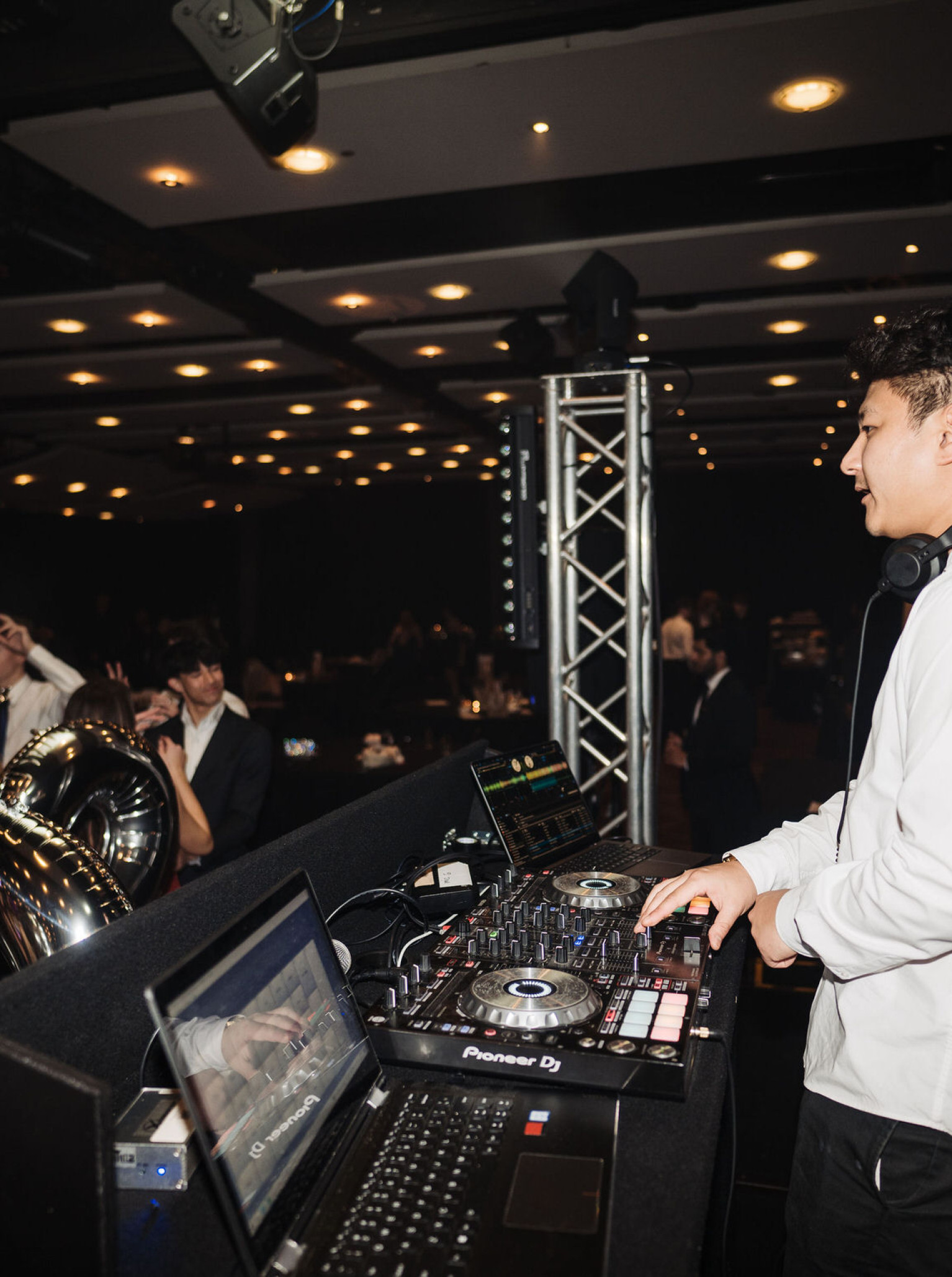
Event Suppliers
See all suppliers
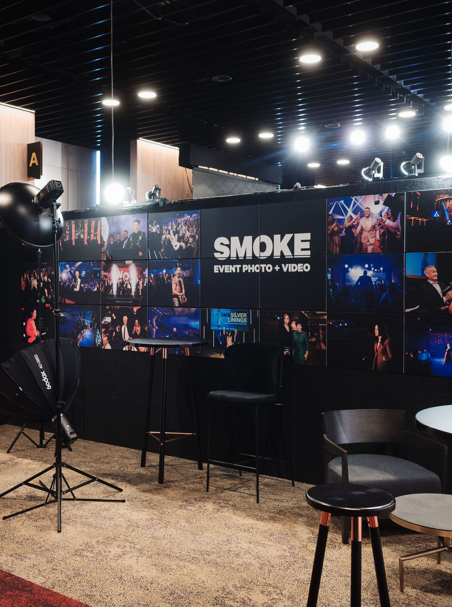
Smoke - Event Photo + Video
Smoke is a team of dedicated and spirited photographers. Their target is truly excellent event photography, unrivaled by all else.
Darby & Grey Event Hire
When you need to make an impact, our innovative range of furniture is designed to bring an enhanced look that will ensure your next event stands out in style and sophistication.

Congress Rental New Zealand
Leading Supplier of Interpretation, Silent Conferencing and Microphone Hire in New Zealand. With live conferences, there is no second chance! You need the best in the business standing by you to guarantee success!
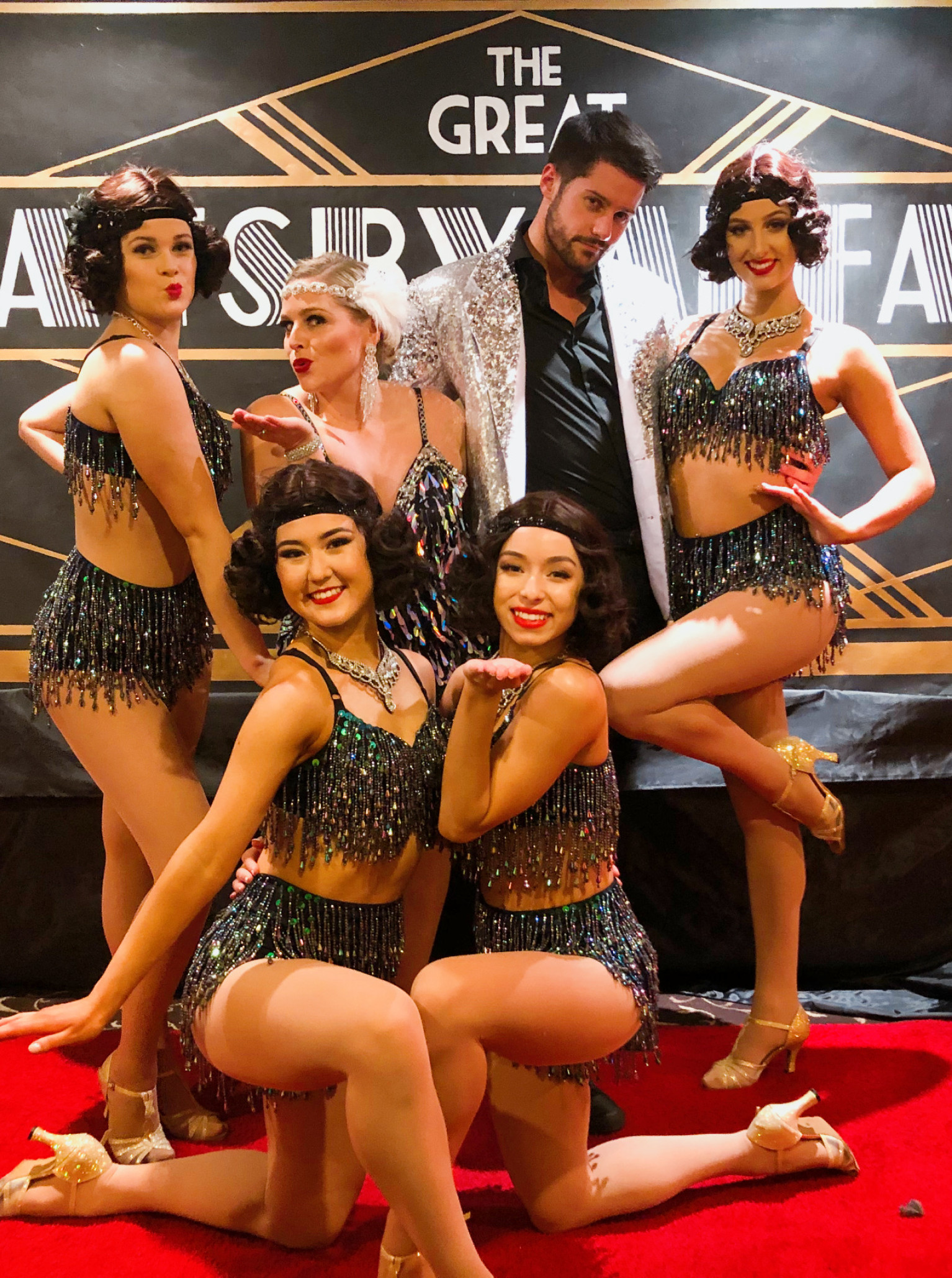
Les Follies
Les Follies is here to bring you entertainment like none other, with a bang and burst of sparkle. We want to infuse your event with all the glitz and glamour of performances of every kind.
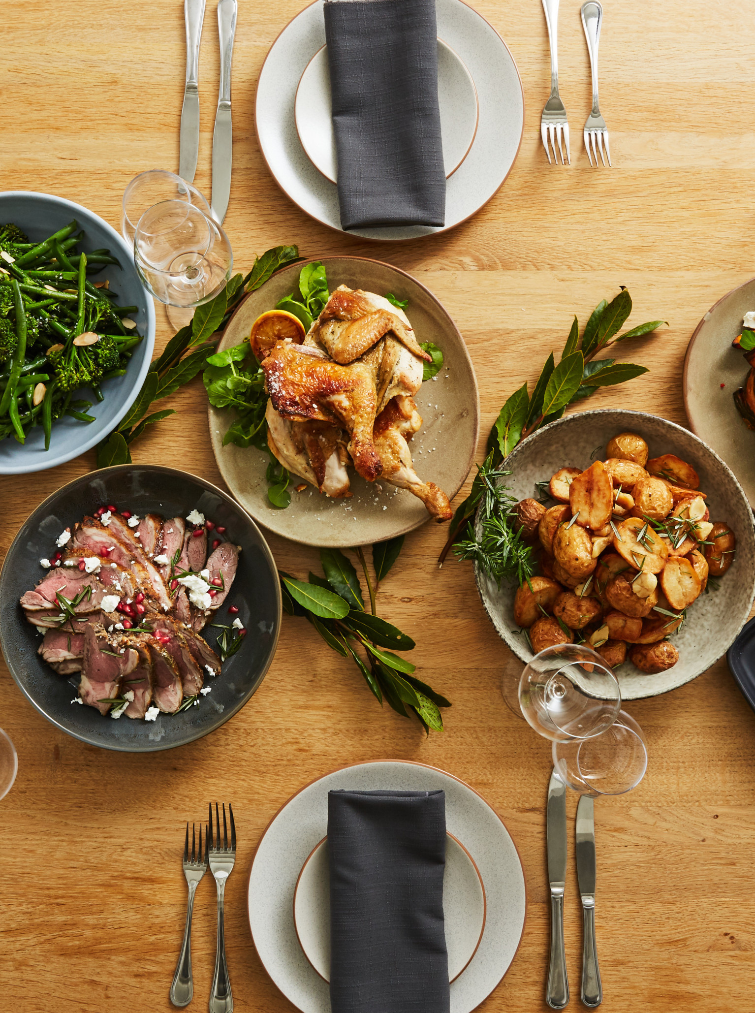
The Great Catering Co
We have proudly delivered great catering and seriously delicious food for over twenty years. Time flies when you’re having fun! Now we’re pushing the boundaries of expectation, flexing a little muscle, and turning our talents towards innovative concepts and creative executions.
Black Pineapple Co.
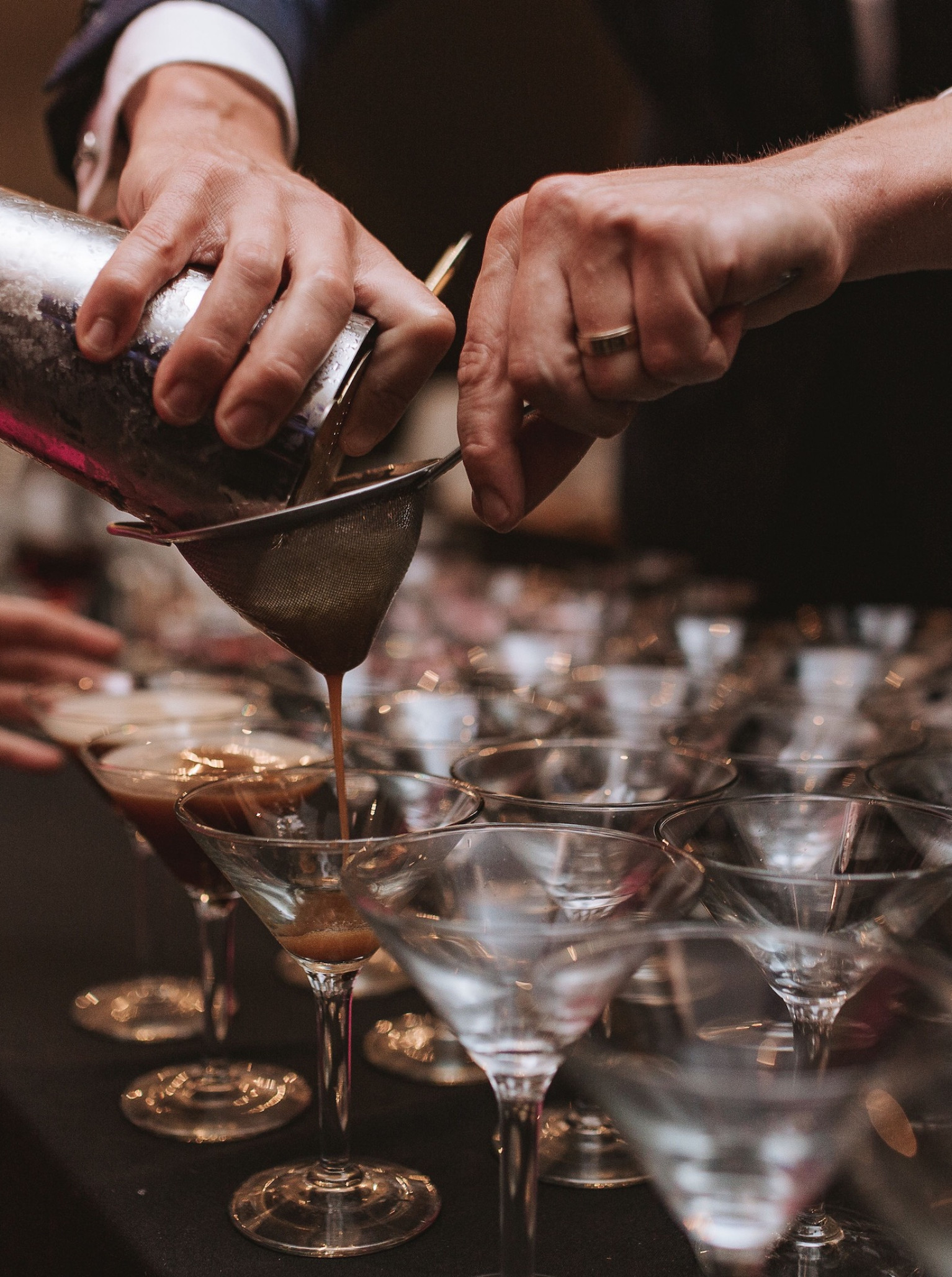
Black Pineapple are the experts of drinks catering. From cocktail parties to gala dinners, they toast to you.
Rooftop
See all venues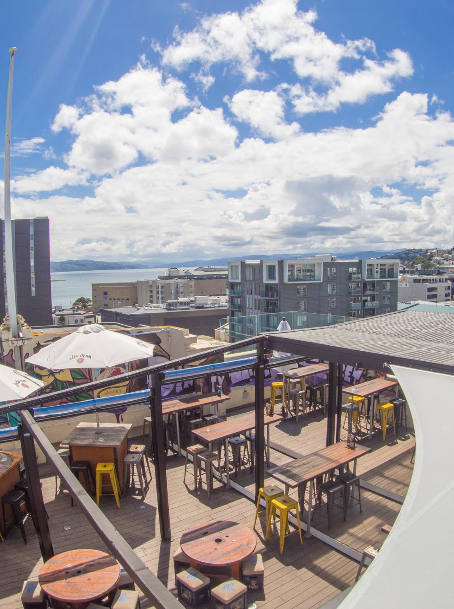
Dirty Little Secret
This industrial-chic hideaway is the perfect spot for your next function or special event, where guests can sip on creative cocktails and nibble on something from our food menu. Perfect for celebrations, birthdays and corporate events.
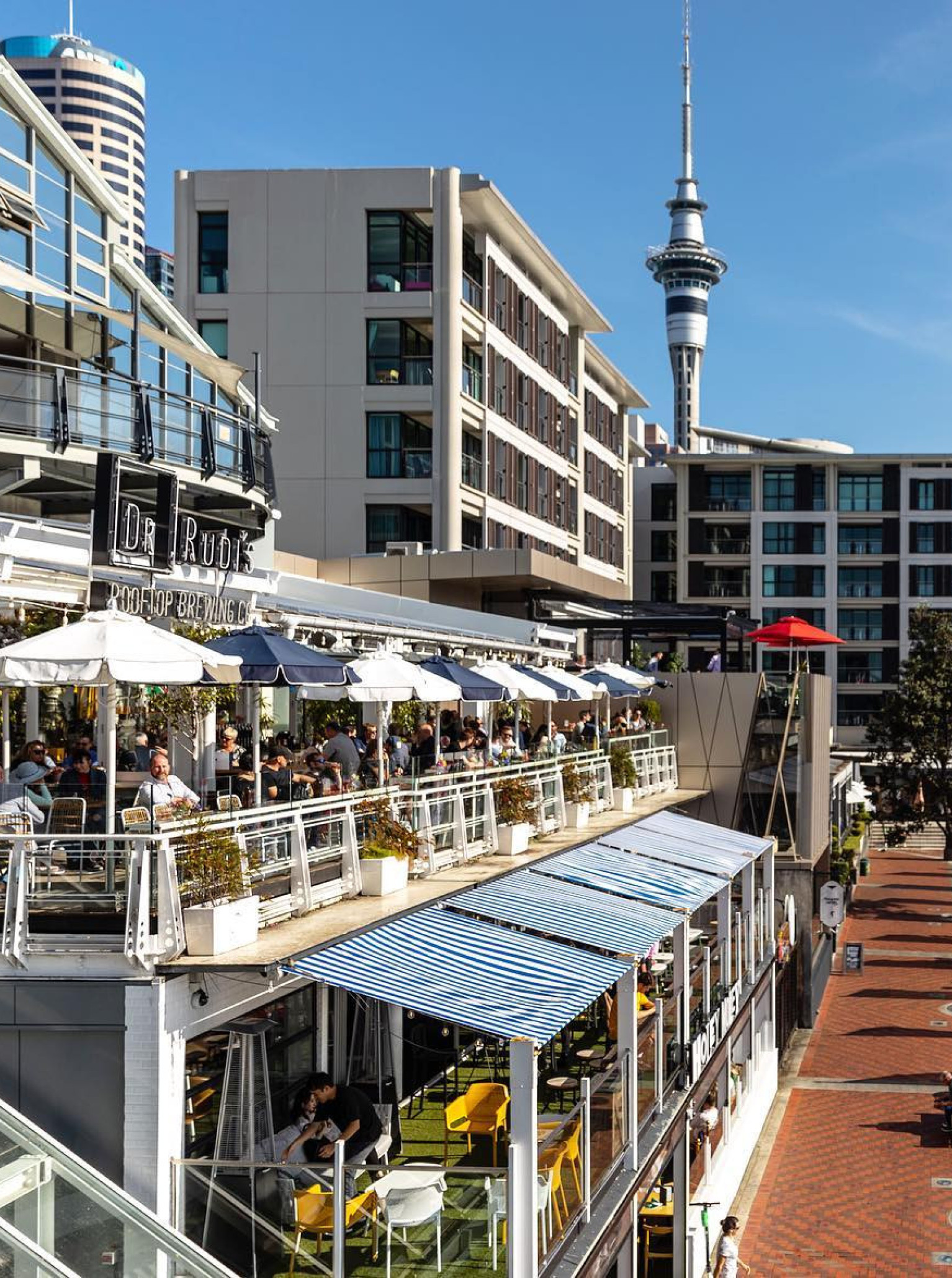
Dr Rudis
Perched on the 2nd level overlooking Auckland’s Viaduct Harbour & perhaps the best rooftop spot in the world for brewing, drinking, eating & socialising.

Heritage Queenstown
Offering spectacular uninterrupted views over Lake Wakatipu and The Remarkables mountain range. Heritage Queenstown ticks all the boxes
Riverside Market
Riverside Market is an award-winning 7-day destination indoor trading market, in the heart of the city, offering a unique after-hours event experience.
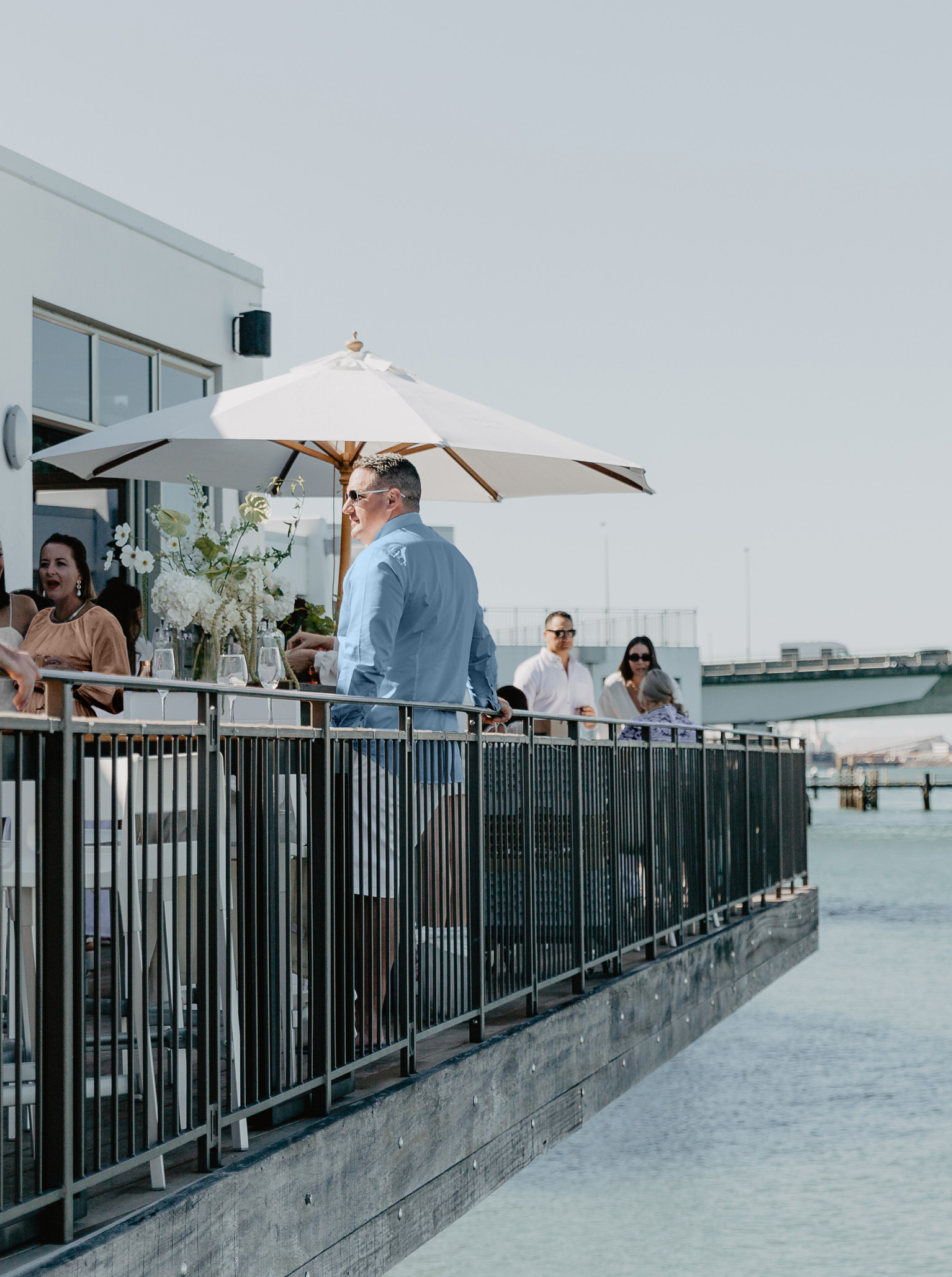
Trinity Wharf
Few event and conference venues can match the outlook at Trinity Wharf. Trinity Wharf is a premium hotel and conference venue owned by a local family whose dream was to highlight the beauty & spirit of the Tauranga harbour and surrounds with this stunning over-water hotel.
Generator Britomart
Britomart Place has been designed with style in mind. Overlooking the Auckland waterfront lies four stunning event spaces - perfect for both corporate and social occasions.
Rydges Auckland
Rydges is one of the most breathtaking venues in the City - presenting uncompromised harbour views from the Rooftop.
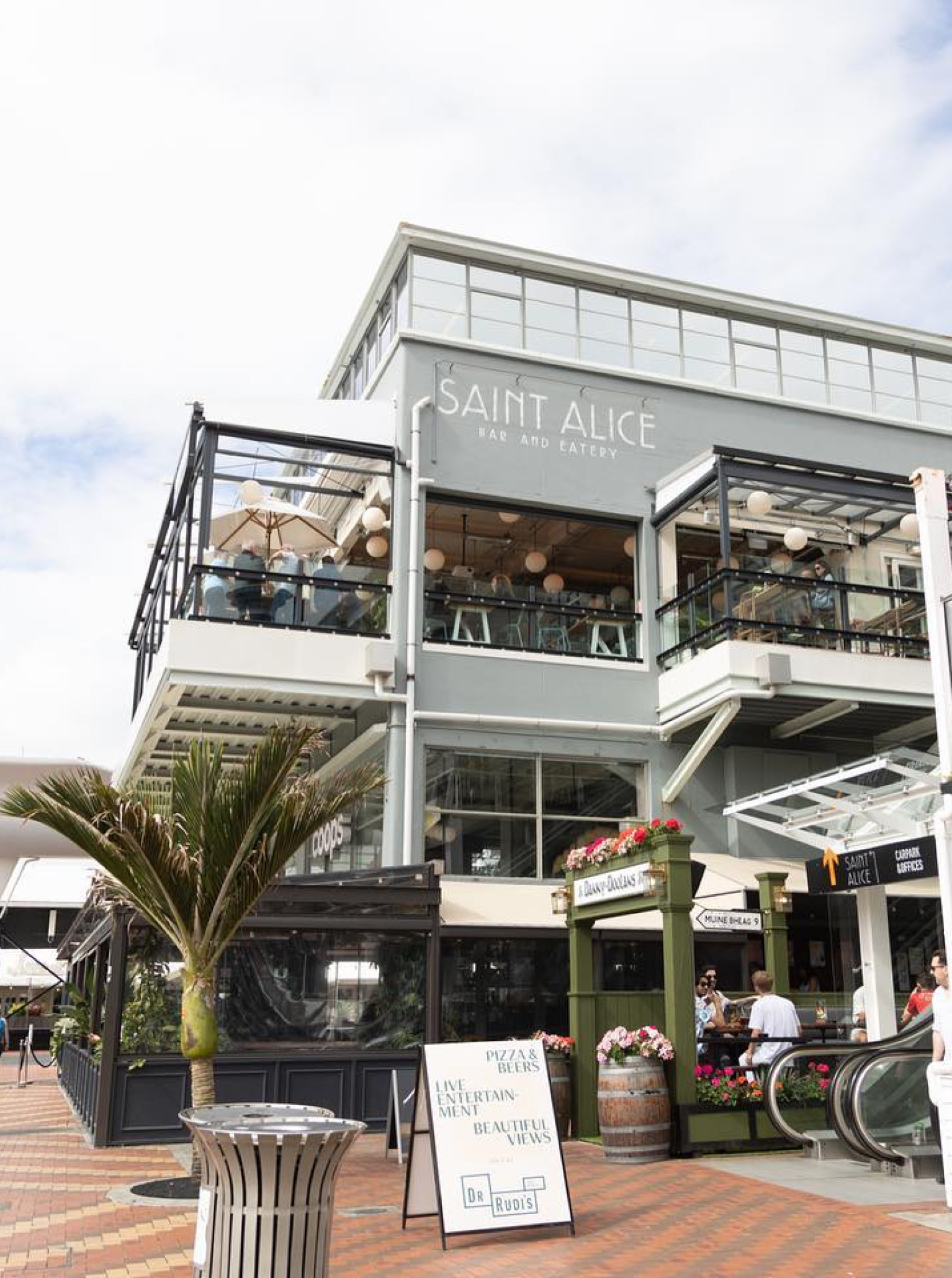
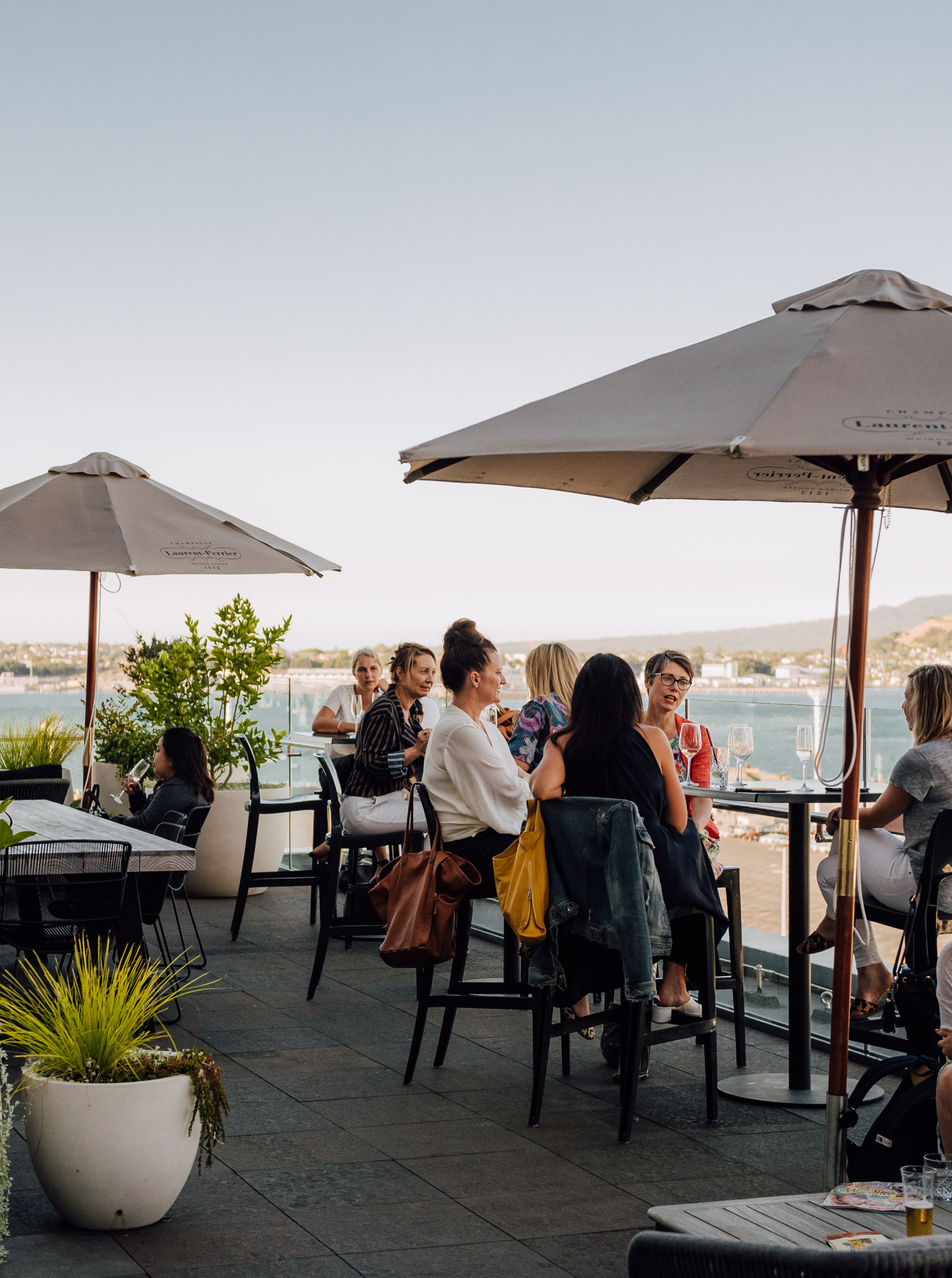
Saint Alice
You'll find Saint Alice where the city meets the sea. A vibrant bar and eatery on the water's edge, Saint Alice does hospitality like no other.
Foxglove Bar
Located in a beautiful heritage building on Queens Wharf, Foxglove Bar & Kitchen is a Wellington venue with three event spaces.
Pullman Auckland
OUR WORLD IS YOUR PLAYGROUND Standing tall as one of the largest conferencing hotels in the city, Pullman Auckland is an event planner’s paradise.
QT Auckland
QT Auckland is an eclectic, harbourside hotel venue with a glint in the eye, serving shoreline shimmer. Whether hosting a vibrant birthday gathering or a more exclusive affair, they'll dress all types of events in a warm QT glow and guarantee a touch of Auckland city wonder.